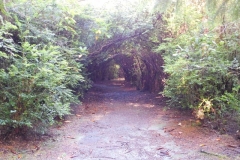
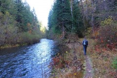
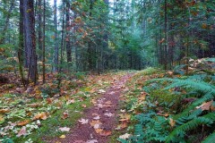
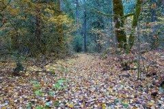
Boundary Springs – September 5, 2020

Hike Coordinator: Brad Bishop

Narration from “Richard Hikes” by Richard O’Neill

The Great Oregon Burn Zone Tour of 2020 continued on a bright summer day in early September with this hike to Boundary Springs. The lodgepole forest surrounding Boundary Springs had perished in the same fire that had immolated the Red Cone area, the locale of my prior hike. But hey, I often say there is great beauty in a burn zone so apparently this has been one especially beautiful summer!

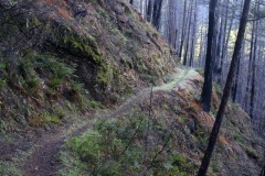
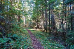
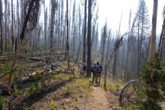
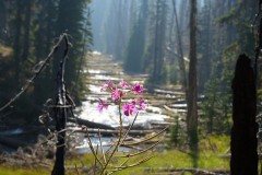
The thin lodgepole forest surrounding the Boundary Springs Trail was absolutely decimated in 2015’s Crescent Fire. No tree survived, the destruction was utter and complete and all that remains of the forest are countless acres of ghostly white snags standing upright, resembling on a larger basis so many porcupine quills in a dog’s snout. I still can’t fathom how fire can irrevocably and completely destroy an entire forest, yet spare all the mosquitoes. The adult trees were left lifeless as a statue but life always finds a way and hundreds of little lodgepole seedlings were already taking root at the feet of their deceased parents.

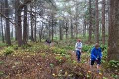
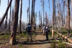
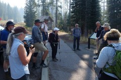
Life also abounds in the form of a hiking club and eleven of us set foot on the Boundary Springs Trail, mouths collectively agape at the terrible yet awesome sight of a totally destroyed forest. Also in keeping with this summer’s theme of hiking in lodgepole forests (be they dead or alive) in volcanic soils, those of us at the tail end of the hiking line ate everybody else’s dust kicked up by scuffing boots.

It didn’t take long for a ravine to appear on the left side of the trail with a small creek coursing at the bottom. Soft soils are no match for moving water and this small creek was eagerly engaged on its short journey to join up with the nearby Rogue River. Be it small, nonetheless the creek had cut a sizeable canyon in all the soft pumice and volcanic ash that surrounds nearby Crater Lake.

Without preamble or ceremony, the trail dove down into yet another canyon, crossed the adolescent Rogue River, and then climbed up to the opposite side of the canyon. Boundary Springs is so named for its proximity to the north boundary of Crater Lake National Park and before long, we passed a sign commemorating entry into the park, but we had no issues getting past customs.

Because the moist air next to the river offered some protection from the wildfire, there is ample greenery flourishing right next to the Rogue. Small grassy meadows were interspersed between tall healthy trees sporting green leaves and needles, the vegetation being most alluring to hikers slogging away in the hot and dusty environs above the canyon. Good thing then, that the trail began a steady descent down to river level and subsequently, to Boundary Springs itself.

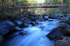
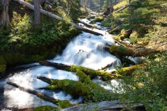
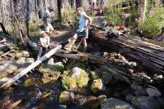
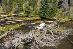
The river was shallow and a multitude of fallen trees and logs clogged the flowing water, creating a series of natural fish weirs. I’d be tempted to say the logs fell into the river because of the fire, but the river channel has been log-littered since long before my first pre-fire hike here, so maybe it’s just a Rogue River thing that occurs naturally. Despite the relative shallowness of the river, there are a few places where the river had to funnel into a narrow chute, giving rise to several photogenic cascades and waterfalls. As a precursor to Boundary Springs, all manner of seeps and springs began to gush forth next to the trail with ever increasing frequency. Moss and other assorted greenery flourished next to all the seeps, taking full advantage of the free water available just for the taking.

Boundary Springs is a special place because it’s just not every day where a full flowing river emerges from the ground. You can stand on top of the springs, look downstream, and the Rogue River will look just like a genuine river should. Turn around and look upstream though, it’s a different story: nothing but dry ground and burned forest with nary a drop of water to be seen. Apparently there’s no stream in upstream! Because the water has been filtered clean during its long underground journey, there is nothing like a gulp of fresh Boundary Springs water. All life should be just like that drink of water.

While the Boundary Springs Trail continues deeper into Crater Lake Park, becoming part of the Bald Crater Loop (described in the previous blog about Red Cone Spring), our business here was finished for the most part. Some of us went to visit West Lake while others just hiked straight back but all wound up eventually at the Boundary Springs Trailhead. The parking lot was full because apparently everybody wants to be outdoors during a pandemic and the trail had been noticeably busier than normal. Evidently we were not the only people out and about on a Great Oregon Burn Zone Tour.

Read about this hike on Richard O’Neill’s Blog

More pictures on Richard O’Neill’s Flickr page and Lane Harris’ Flickr page

Pictures below by Lane Harris

Wild Rose Point and Devils Stairway – August 22, 2020

Hike Coordinator: Lane Harris

Narration by Lane Harris

An even dozen hikers made the drive up Illahee Road to the trailhead east of Illahee Rock. While short, this hike was very sweet. The route traversed a spectacular fire-scarred rocky ridge with expansive views down into the Boulder Creek Wilderness. It was a short, but rough trail to get to Wild Rose Point. After a short repose, the group continued further up towards the ominous sounding Devils Stairway. This part of the trail was more friendly to the hiker’s feet, but it was a bit more uphill than the first part of this hike. The trail to Devils Stairway crossed through several large meadows before ascending up through colorfully flowered rock gardens and eventually reaching the Stairway itself.

A nice long break was had by everyone, as we marveled at the views to the north, picking out notable mountains like Fairview Peak and Bohemia Mountain. To the south lied Mt Thielsen and Mt Bailey.

As they say, it was all downhill from here! Literally, it was all downhill from here. We got to enjoy the hike in reverse this time, but with less effort.

This trail has seem some neglect over the years, but for the more adventurous souls, it’s worth the extra effort to get to and explore.

More pictures on Lane Harris’ Flickr page

Pictures below by Lane Harris

June Lake – August 8, 2020

Hike Coordinator: Richard O’Neill

Narration by Richard O’Neill

A small group of 3 hardy souls followed their fearless leader (me!). After reaching June Lake, we tacked on a side trip to spectacular Indigo Lake for some extra mileage, before sideswiping Timpanogas Lake and Little Timpanogas Lake for a very worthy 8.4 mile hike.

More of this hike from “Richard Hikes

More pictures on Richard O’Neill’s Flickr page

Pictures below by Richard O’Neill

Umpqua Spit – July 25, 2020

Hike Coordinator: Lane Harris

Narration by Lane Harris

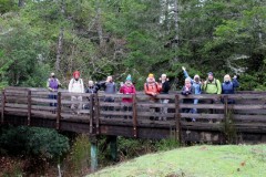
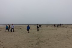
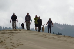
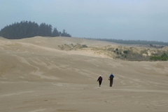
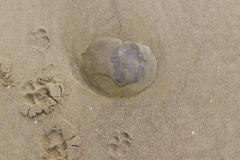
A good dozen or so hikers showed up for this ‘nothing-but-beach’ hike along the northern stretch of land that lies near the mouth of the Umpqua River, otherwise known as the Umpqua Spit. The parking at the end of Sparrow Park Road was limited, as it was filled with vehicles belonging to all the weekend nature lovers. Whether they were there to fish, picnic, or just frolic on the beach, it was quite a surprise to see that many people in one area. Then again, this year was the year to be outside since it was safer than being indoors with a bunch of strangers.

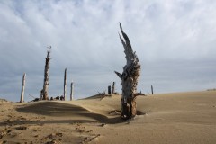
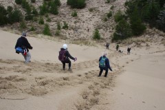
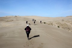
Once on the beach, we headed south and away from the hoards of people near the entry point to the beach. We enjoyed the sand under our boots and the fresh air. We then enjoyed more sand under our boots…. You get the picture.

Some of our group turned around early, probably because they were eager to know what it was like to walk on sand in the northbound direction. The rest of us continued south, with Brad being the only one completing the entire route to the tip of the actual spit.

After a casual lunch on logs, we headed back north to enjoy, you guessed it, more sand walking! Brad did eventually caught up to our group. We paused for a minute after Wendy’s curiosity led her to a group of people digging in the sand. Not clams or oysters, but it was worms they were digging up! They had a bucket with the creatures in it, whose fate no doubt would be at the end of a hook to lure in some sort of seafaring delicacy. After Wendy offered to give the worm digging activity a try, she did manage to get one! We then graciously thanked the sand people and went on our way.

The walk back was hindered by the insistent northerly wind that seemed to knock us back one step for every two steps we took, making the hike back a little bit tougher than the first half of this beach walk. Nonetheless, all hikers were accounted for in the end, and all that was left to do was knock the sand off of our boots.

More pictures on Lane Harris’ Flickr page

Pictures below by Lane Harris
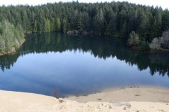
North Umpqua Trail: Swiftwater Segment – July 11, 2020

Hike Coordinator: Rheo Wheeler

Narration from “Richard Hikes” by Richard O’Neill

This was my fourth hike in eight days. Two of those hikes had been plenty rigorous, working out those leg muscles via plenty of uphill grade coming on the way to a mountaintop summit. So, when the daunting climb up and over Bob Butte on this hike on the North Umpqua Trail presented itself, my legs were plenty up to the challenge, scoffing “So, what about Bob?” Wow, it seems like if you exercise regularly then your body responds in kind by improving muscle stamina and strength while shedding some of those unnecessary pounds too. Who knew?

Because this has been the year of Covid-19, I’ve been mostly hiking alone. However, Oregon had recently modified the restrictive stay-at-home order and accordingly, the Friends of the Umpqua Hiking Club cobbled together a small schedule of outings, with some limitations so as to comply with the new guidelines. Accordingly, it was kind of nice to (legally) hike with people again. Since one of the limitations voluntarily implemented by the club was to keep hikes fairly close to home, it only stood to reason that the North Umpqua Trail would make it onto the roster of upcoming hikes.

There were several options for hiking distances and routes but about half of our rather large (given the club’s self-imposed group limit) and enthusiastic group opted for a straight-through hike on the Swiftwater Segment of the North Umpqua Trail. Rheo had graciously agreed to ferry us back to our cars at the end of the hike, hauling us in the back of her pickup like so many sacks of garbage on their way to the dump. We didn’t complain (within earshot of Rheo) because the shuttle allowed us to experience the eight-mile segment in its entirety.

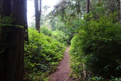
It was obvious early on that this hike would be mostly about the lush forest growing next to the North Umpqua River. For the majority of the first four miles, the trail was mostly level and the vegetation lush, with tall trees providing plenty of shade which was appreciated on a warm summer day. The river was mostly heard but seldom seen as the forest cover did a pretty good job of obscuring the view much like the broad-shouldered dude wearing a cowboy hat that always manages get the seat in front of you at the movie theater.

This area had been ravaged by fire several summers ago and after a couple of miles, the green forest was replaced by a dead forest with acres of ghostly snags reaching up to the blue sky above as if to send their forest fire anguish up to the heavens. However, death is part of life and vise versa, and the forest was already well on its way to recovery from the conflagrations of summers past. Because of the increased sunlight in direct proportion to the increased number of dead (ergo, shadeless) trees, sun-loving vegetation was flourishing in rampant exuberance. Fireweed, and thimbleberry were the main culprits but there were also plenty of young big-leaf maple trees taking root, in a sure sign that the forest will return at some point.

In winter and spring, there are a number of seasonal creeks that cross the trail but on this summer day, the temporary creeks had pretty much all dried up. One exception was the creek at Fern Falls, a highlight of the hike that shows up at just under the two-mile mark. The fire has done a number on the formerly photogenic cascade, for now the small creek gully is choked and littered with fire debris such as trunks, limbs, and tree parts, generally. The increased sunlight supports a healthy layer of vegetation that further obscures the waterfall. While the hike is enjoyable and beautiful, the small cataract is not as impressive as it used to be.

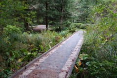
Shortly after crossing on a footbridge spanning a nameless creek flowing in a deep gully, the live forest returned and just as we were beginning to overheat in the sun like lozenges melting on a hot sidewalk, we returned to the shade and there was much rejoicing. The cool forest was very much appreciated and the whole vibe was ferny thanks to sword ferns brandishing their fronds on the hillsides and over the trail as we hiked by.

At the four mile mark, the easy level walking ended as the trail inclined upward and began the climb up and over forested Bob Butte. From a technical aspect, I’ve never understood why the trail designers engineered this taxing section of trail this way, for it seems to me that the route could have just continued along the river like it had been doing for the first four miles. But obviously, it does prove that trail designers don’t ever hike on the trails that they create, at least in this world. Although, they may forever have to hike on them on a warm eternal day, if you get my drift. However, after this week of constant hiking, my legs were more than up to the would-be daunting task of climbing up and over the butte. As I hiked, I contemptuously sneered at the uphill grade except for when nobody was watching.

However, despite Bob Butte’s lone failing of having a steep trail on it, the mostly wooded mountain did provide one of the main highlights of this hike. After cresting the high point of the hike, the venerable North Umpqua Trail then drops down to Bob Creek. On the descent, the slope sheds the trees and goes all rocky and grassy on us, with just a few odd oak trees scattered here and there. Accordingly, the open slopes provide a nice view up the North Umpqua River canyon, but on this day that vista was upstaged by a flowering clarkia known as Farewell-to-Spring, so named because the blooming clarkia is a sure sign that summer has arrived. The grass on the open slope was all dull and drab, having browned out weeks prior. However, the ample quantities of Farewell-to-Spring absolutely colorized the brown slopes in a spectacular display of pink interspersed with purple, thanks to some elegant brodiaea flowering in between all the clarkia. It was truly stunning and wondrous.

However, it was a bit too sunny and warm to comfortably lunch and laze in the rocky meadow, flower display notwithstanding, so our little hiking subset consisting of me, Wendy, Coreena, Misty, and canine pal Arlie walked just a bit further to the bridge crossing of Bob Creek. I don’t know who Bob was but he certainly has stamped his brand on all named things in this area. At any rate, we enjoyed the rest, the shade, the rushing creek, and ghost pepper infused sandwiches. Well, maybe just one of us enjoyed that last item.

From Bob Creek, a short uphill push took us up and away from the creek bounding in its ferny forested canyon and once the trail crested it was all gradual downhill at that point, and legs were thankful. The trail is an old forest road here and it was plenty wide enough for us to walk abreast as we hiked in easy companionship. Normally, I hike this section in the winter and on this summer day, all the seasonal creeks and cascades were just an evaporated memory, as fleeting and impermanent as a wisp of steam rising from a teapot spout. However, the forest was still lush and plenty green and it was a pleasant and shady walk before we polished off the hike with a crossing of the North Umpqua River on Tioga Bridge, where a short and breezy return shuttle in the bed of Rheo’s truck awaited us.

More pictures on Richard O’Neill’s Flickr page

Pictures below by Richard O’Neill

Riverview Trail – March 21, 2020

Hike Coordinator: Brad Bishop.

(NOTE: This was the last hike by the club prior to Oregon closing down all national forests and hiking trails due to the coronavirus pandemic. We hope to resume hiking soon after all restrictions have been lifted and it is safe to hike the trails again.)

On a beautiful early spring day 13 socially distanced hikers made the drive to Steamboat to get in some much-needed leg stretching and exercise. On this out and back hike, some chose a nice easy out and back, some went a touch farther to Bogus Creek for a socially distanced lunch and still others went point to point ending up at Fall River. Everyone seemed to enjoy getting out in these weird times and the weather could not have been better. Keep informed and healthy and see you next hike.

More pictures on Lane Harris’ Flickr page

Pictures by Lane Harris
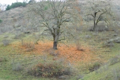
Cooper Creek Reservoir – March 7, 2020

Hike Coordinator: Diana Pace

“The McKenzie River Trail is a spectacular spring hike along the quick-flowing waters, offering early glimpses of beautiful budding flowers, as well as a quintessential walk through thick evergreens and marvelous deciduous trees.”

That may very well have been the opening line for this hike, had we actually hiked the McKenzie River Trail as planned. But the weather forecast for that area didn’t seem promising, with a mix of rain and snow predicted for our hike. So, it was decided to hike elsewhere.

There were six hikers who showed up to “brave” the weather at Cooper Creek Reservoir. The forecast called for morning showers, tapering off around midday. But so far, it wasn’t raining, nor was it too cold. And it didn’t take long at all to reach the trailhead at the dam on the west end of the reservoir near Sutherlin.

Our group consisted of Diana (hike leader), Rheo, John, Lane, Julie and David. In typical fashion, John immediately jetted out in front, with Julie in close tow. Lane meandered around in the middle while Rheo and Diana brought up the rear. David let the group know that he had to take it easy and would be going slow and that he would not be hiking the whole trail. So we basically said our goodbyes to him from the get-go and bid him farewell.

The skies were partly cloudy, partly sunny, but mostly promising. We were still waiting for the morning showers to make their appearance, but as we made our way further and further down the trail, it seemed less likely that we were going to get rained on. In fact, we were fortunate enough to have not one rain drop fall on to our dry foreheads during the entire hike.

The trail weaved its way in and out of small creek drainages on the south side of the reservoir, and even had gentle hills to climb up and down, giving it that true hiking trail feel. The Sutherlin Rotary Club did an excellent job on this trail, in fact. It apparently replaces an older trail, whose remnants are still visible in places alongside the new trail.

Much logging had taken place on the hillsides just above the trail. Vast clear cutting had been done last summer, at some points right down the trail’s edge. Although it doesn’t make for the most scenic views, we do live in Oregon, so this is certainly not unusual.

On the far east end of the reservoir the trail crosses a large open field and then emerges onto a gravel road. A short quarter mile walk on the road led to the trail again, this time winding it’s way along the north side of the reservoir. The view from the north side is a lot different and much more open. Grassy fields made for great views of the sun reflecting off the water. It was easy to forget that a road paralleled the trail just mere yards up the hill out of eyesight, just as it should be.

Upon reaching the boat ramp, John and Julie reversed direction and made a lunch stop at a picnic table on the shoreline. Lane soon joined them, but Rheo and Diana chose to continue on with a road hike back to the vehicles. It’s estimated they hiked about 6 miles.

After lunch, John, Julie and Lane hiked back from whence they came, enjoying the views again, this time in reverse. It was noted that Julie matched John’s pace, and in fact, she eventually took lead position. John and Lane were able to keep up with Julie’s fast pace, but not without some labored breathing as they sped up and down the hills. Those darn young people and all their energy!

After finishing the hike with 8 miles on their boots, the three speedsters arrived at the vehicles exactly at noon, greeted by dutiful hike leader Diana, who was awaiting for their safe arrival. All hikers piled into vehicles and another hike was in the books. It was determined that this trail is a good backup option if bad weather or other calamity forces us to cancel hike plans elsewhere.

It wasn’t even 10 minutes after leaving Cooper Creek that the heavens decided that now would be an ok time to spill their liquid goodness all over the earth. It started out as a sprinkle and quickly turned into pouring down rain! So, the morning showers we were expecting showed up late. Which makes for very happy hikers.

Pictures by Lane Harris
More pictures of this hike on Lane’s Flickr page

Calf and Panther sections (N.U.T.) – February 8, 2020

Hike Coordinator: Lane Harris.

We had a great turnout for this hike, about 20 people showed up to brave what little rain actually ended up falling. Overall, the weather treated us about as good as one can expect in early February.

Although about half dozen of the hikers chose to only hike the Calf section and put out at Apple Creek, the rest of us continued on the Panther section, eventually arriving at Mott Bridge near Steamboat.

February must be that time of year when mushrooms and other fungi have had their heyday earlier in the winter, and the spring flowers have yet to begin blooming. That being said, there were still signs of mushrooms here and there, but nary was there a flower that was worth taking pictures of.

But with the lack of colorful flora notwithstanding, there were plenty of nice little waterfalls here and there that prompted photographers to at least take a few photos. And the forest, in all it’s glistening green glory, is always a treat to experience. The mosses, ferns and evergreens were abundant as ever. If you don’t care for the color green, then you are in the wrong state!

Narrative and pictures by Lane Harris
More pictures of this hike on Lane’s Flickr page

Cape Blanco (via Sullivan Gulch) – January 25, 2020

Hike coordinator: Richard O’Neill

Richard led a group of about 8 regular hikers from our club, and about 21 from the South Coast Striders hiking club on this first-ever hike from Sullivan Gulch to Cape Blanco. The weather was dry. It was also wet. It was a little bit of everything. But it was extremely enjoyable for the extra large group that made the effort.

You can read all about this hike on Richard’s Cape Blanco (via Sullivan Gulch) blog.

More pictures on Richard O’Neill’s Flickr page and Lane Harris Flickr page
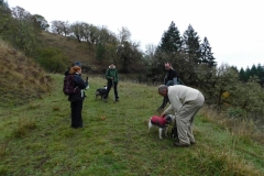
Pictures below by Richard O’Neill and Lane Harris

Scroll Up