Bullards Beach – August 6, 2022

Hike Coordinator: Richard O’Neill

Narration by Richard O’Neill

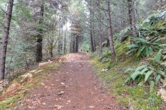
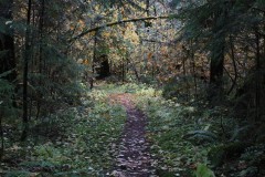
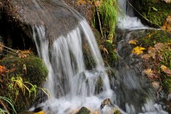
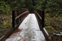
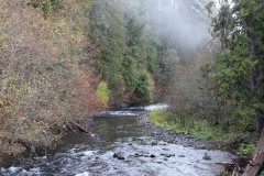
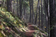
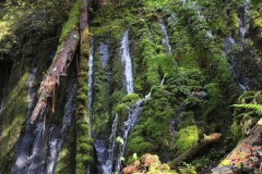
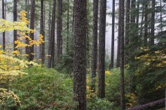
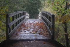
Even though the club hiked this one hike on one certain Saturday, the club outing on the Bullards Beach horse trails was really about three hikes.

The first hike was a Cascades Mountains hike, a relatively easy amble to Nip and Tuck Lakes, which was the original destination for the club. However, the Windigo Fire burst into flaming existence, thanks to a round of lightning storms hovering over dry forests. Since the Nip and Tuck hike began at like-named Windigo Pass, it stood to reason that we might not be hiking there. It became official when the Forest Service closed off large swaths of land, trails, and roads in the Windigo Pass area. Time for Plan B.

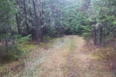
When the mountains are aflame, then the coast seems like a logical choice. So off I went several days before the actual hike, to test out a route on the Bullards Beach State Park horse trail system. Comprised of the Cut Creek, North Loop, Three Mares, and Pearl’s Trail(s), plus one other nameless trail that runs along the Bullards Beach Road between campground and beach. There’ll be a pop quiz in the morning, boys and girls.

There were two drawbacks to that 7-mile route: virtually all of the loop was on soft sand, and the last half was in shadeless sand dunes and dang, the warm sun baked my noodle as I trudged along. I needed to make some changes, otherwise my fellow hikers would hate me more than normal.

The first change was to hike in the opposite direction so as to get the dunes out of the way first when the day would be cooler. The second change was to replace the Cut Creek Trail segment with a walk on Bullards Beach itself, trading in three miles of soft sand for some hardpack on the beach.

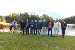
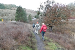
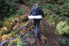
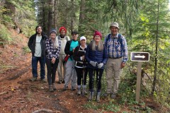
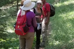
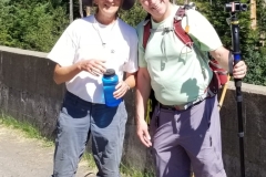
Approximately 10 hikers (including two friends from the South Coast Striders) hit the trail, totally unaware of my travails in cobbling together the route. Soft sand was still soft sand, though, and leg muscles were soon aflame like the forest at Windigo Pass. But, at least it wasn’t as hot as it could get in the afternoon.

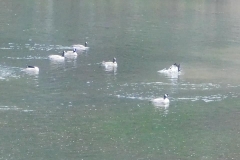
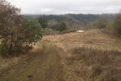
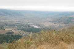
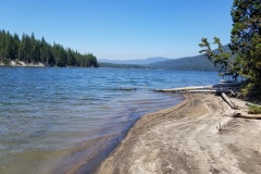
The cool part (literally!) was that after the trail crested and dropped through a series of grassy pastures, the fog rolled in and there’d be no threat of hot sun for the remainder of the day. There’d be little to no visibility either, as the thick fog limited our vision to about 15 feet or so. As we straggled down the beach, we all appeared to each other like spectral hikers from the underworld, ghostly in the thick fog.

Our egress off the beach was Exit 147 and it was an open question as to whether we would see the sign or not. But the exit signs are painted bright yellow and it was just enough color for us to notice as we trod along in our colorless world of gray. So, while our original hike had been nipped and tucked by the Windigo Fire, we did make do in fine fashion.

Read more about this hike on Richard O’Neil’s blog, Richard Hikes

More pictures on Richard O’Neill’s Flickr page

Pictures below by Richard O’Neill

Rattlesnake Mountain – July 23, 2022

Hike coordinator: Edwin Case

Narration by Lane Harris

If you look at a map you’ll see that Rattlesnake Mountain, Mosquito Lake and Windy Gap are all within a mile of each other. It sure doesn’t sound like a very friendly place to visit. Despite the threatening names given to these various land features, this area in the Rogue-Umpqua Divide Wilderness offers some of the most stunning scenery in our neck of the woods. Perhaps the names were a way to keep hoards of people away from enjoying the beauty of this area. What they should really worry about is the drive to get to the trailhead to Rattlesnake Mountain!

Edwin managed to attract a baker’s dozen for his steep trek to the top of rattlesnake Mountain. But first, he had to get them there…

The route to get to the trailhead in Fish Creek Valley south of the mountain consists, in part, of several miles along a dusty, pothole-filled road. With thick vegetation reaching out to scrape the sides of vehicles, its not the most vehicle-friendly road I’ve been on. However, there are worse roads out there, and at least this one didn’t require 4-wheel drive on this warm July day.

Arriving at the trailhead, hikers laced up their boots and began the march towards the mountain. The first mile was a steady climb along what is really Castle Creek Trail that unsurprisingly originates at Castle Creek. Taking a right at the junction, the trail climbs up to the intersection at Windy Gap. None of us detected any wind here, although we wish there was, as it was starting to get warm. We continued up the Rattlesnake Mountain Trail, and this is where the “difficult” part of the hike really begins to kick in. The trail sidewinds it’s way along the southern side of the mountain, with a fair number of steep parts that make you rethink this hobby called hiking. The saving grace were all the wildflowers that adorned the steep hillsides, along with the many meadows, giving hikers with cameras excuses to stop and take pictures while they catch their breath.

Eventually, and certainly not soon enough, the path took a westerly turn and took a much more gradual approach towards the top, taking us hikers through one of the largest meadows we would encounter this day.

This large meadow near the top afforded us southerly views as we languished in the casual stroll toward the western edge of Rattlesnake Mountain. Eventually, the trail more or less disappears, as adventurous hikers are likely to explore every which way up here. But our destination was the rocky overlook on the western side.

Upon arrival, most of us immediately divested our backpacks and just plopped ourselves on the ground, while others strategically claimed rocky surfaces near the edge of the cliff. Although the views here are limited to mostly to the west and south, they were nonetheless views.

After finishing our mountaintop lunch, the group gathered up and we did some exploring near the northern tree-covered side of the mountain. There, we discovered what was once, to the best of our knowledge, remains of an old lookout. Giant cement blocks indicated that the structure that once stood here was substantial. Some wisecrack comments were made about the poor souls who had to pack these huge cement blocks up the hillside. Obviously, that’s not true, as the likely mode of transportation for these behemoths would have been done by helicopter.

After the history show, we looked forward to making the trek down, this time appreciating the meadows without the heavy breathing like we did on the way up. It was getting warmer by the minute as we hiked down, but at least it was down! We took a left at the Windy Gap intersection, which took us onto new trail. At one point, the trail crosses a small creek, giving hikers two options to traverse it: A log that stretched across to the other side, or the mundane lower path where hikers could just hop across the creek. With the exception a few hikers, everyone else chose the somewhat challenging, but mostly safe log option. Fortunately, no one ended up in the creek below and we applauded each other for this acrobatic accomplishment.

The remainder of the hike took us through mostly wooded hillsides, eventually culminating in tranquil meadows until we reached the road which was just yards from the trailhead. At this last meadow, we were able to turn around and peer up at Rattlesnake Mountain in awe as we speculated about how we actually hiked up that high. With a 1,500 ft elevation gain, this hike earns a well-deserved rating of “difficult”, but the beauty of the meadows and the overall views made the effort we put into it all worth it.

Rattlesnake Moontain

More pictures on Lane Harris’ Flickr page

Pictures below by Lane Harris

Cowhorn Mountain – July 9, 2022

Hike Coordinator: Coreena Gosselin

Narration by Lane Harris

The planning leading up to this hike was harder than it should’ve been, but with persistence, hike leader Coreena eventually determined that the club could actually hike the ‘ol Cowhorn.

A few weeks prior to the hike, Coreena was unable to even get to the trailhead due to road conditions, thanks to our late snowfall. Then one week before the hike she made it part way up the trail before a threatening thunderstorm and rain chased her off the mountainside. But at least the trail was attainable and she didn’t have to change the hike destination at the last minute.

On the day of the hike, a whopping eighteen hikers headed up the highway toward Windigo Pass and the trailhead. It was around eleven o’clock before boots hit the Pacific Crest Trail, which by the way, was quite crowded with thru-hikers gathering at the trailhead while they refilled containers with fresh water, thanks to generous trail angels.

The climb up to the base of Cowhorn Mountain is a nice steady grade, made backpacker friendly for the PCT folks who have more weight in their packs than us puny day hikers. Nonetheless, the 4 miles of “steady climb” made each of us huff and puff on this warm summer day.

As hikers rounded each corner that had a view looking up at the mountain, many voices could be heard saying, “We’re going up THERE?”. Seeing Cowhorn Mountain from below can be quite intimidating, to say the least. But we pressed on…

Although we began with eighteen eager hikers, that number dwindled some as the trail proved a bit too tough for some as they wisely chose to turn around and call it a day. The remaining hikers continued the trudge up the trail, some perhaps thinking that the ones who turned around were possibly the smarter ones of the bunch…

We hit a few patches of snow on the trail when we were about a mile from the junction that veers off the PCT to Cowhorn. These small icy obstacles did little in slowing us down, as they were easily managed by just walking up and over them.

At the junction, the trail angles off to the right and heads up to Cowhorn. Everything up to this point was just a warmup for the next section, which is a short but extremely steep climb that switches back and forth on a loose, rocky hillside. This is the mountain making it’s declaration to hikers: “If you can pass this torture test, then you are worthy of summiting my peak!” For those who did make this incredibly sheer ascent, they were rewarded with a moderate walk across an attractive saddle filled with red and orange volcanic rock. Tremendous views were enjoyed from this area, but the top of the mountain was calling to some of us, so we continued on…

I wasn’t really sure how many hikers were in front of me, but I did know that number was not eighteen! The last task of attaining the summit of Cowhorn Mountain requires hikers to replace their trekking poles with their hands, as the remaining 50 feet is a scramble up solid volcanic rock. As I reached the top, I was greeted by what I termed as fellow Cowhornians. In all, only eight of us had achieved Cowhornhood, and it was magnificent! Precariously perched atop the small, uneven surface, we ate a well-deserved lunch as we enjoyed the 360-degree views.

If you can name it, we saw it. Crescent Lake dominated the view immediately to the north, and we could make out Diamond Peak, the Three Sisters, and even Mount Washington and Jefferson further to the north. To the south we easily made out Mt Thielsen and Bailey, and even further away, Mt McLoughlin near Medford.

After much oohing and ahhing, we slowly and carefully made the climb off the top, taking in the views once more on the way down. Coming off of Cowhorn Mountain requires attention to detail, as boots tend to slip and slide coming down the scree slope. We met up with the rest of the group who had gathered near the bottom of the mountain near the PCT. From here, it was all downhill.

This 9-mile out and back hike is not an easy hike, by no means. In fact, some of us commented to the newer hikers that if they can do this, they can do any hike that pops up on our schedule. I’m not sure if that remark was received as a compliment meant to encourage them to hike with us again, or as a discouragement to never hike with us again!

Cowhorn Mountain

Read more about this hike on Richard O’Neil’s blog, Richard Hikes

More pictures on Richard O’Neill’s Flickr page

More pictures on Lane Harris’ Flickr page

Pictures below by Lane Harris

Hershberger Mountain – June 25, 2022

Hike Coordinator: Cleve Moss

Narration by Cleve Moss

On Saturday morning 6 hikers came together to go visit the Old Hershberger Lookout. Some had been there before and a couple had not. The weather was to be clear skies for good viewing and on the warm side.

We headed east out of Canyonville toward Tiller and continued along Jackson Creek. Eventually we started to gain elevation which took us to the trail head to Cripple Camp Shelter. We saw a couple of large bucks with racks in their velvet. There was a doe and fawn so small it hid in the ditch brush as we went by. A nice spring black bear was spotted crossing the road.

When we got to the trail head, we were greeted by a few mosquitoes which hurried us to get on the trail quickly. The mosquitoes seemed to not bother us as long as we kept moving. So, when we needed to take a short break a short saying that could be heard went something like this: “Better keep walking because if the mosquitoes don’t get you, the gators will.” We would hear this sound advice several times during the hike.

Most of this hike is through an old mature stand of high elevation timber. At Cripple Camp Shelter there are two large Douglas firs, one probably about 10 feet in diameter and another about 8 feet in diameter. They seemed to say “Welcome!” to hikers as they peered out at the meadow. “My huge arms are here to shelter you from whatever the weather may be!” There were large specimens of Douglas fir, Mountain Hemlock, Pacific Silver Fir, Incense Cedar, Grand Fir and an occasional Sugar Pine throughout the hike. Small Goldened Chinquapin, huckleberry brush, fern, trillium and other blooming plants were scattered across the forest floor. There was evidence of wild fire from the past that was starting to green up along the route.

As we rounded around Todd March Prairie, we encountered a couple small patches of snow. When we crossed Pup Prairie it was lush with green growth with a few blooming flowers. The real show would be in the next week or two. You would expect to see some animals around the prairies, but we only saw a squirrel and a few birds.

During the last 2/3’s mile to the top, the trail steepened, requiring short walks and long blows. We anticipated that the hard climb would reward us with a good view. When we reached the lookout, Hershberger did not disappoint. Rabbit Ears was almost close enough to touch. The sky was clear, giving views of Shasta, McLoughlin, Union Peak, Crater Lake Rim, Thielsen and Bailey were all there to greet us.

The rock garden at Hershberger was composed of heather and paint brush, and the succulents were just starting with many more to come. It can be a pretty showy place when it is all abloom.

The easy trek back downhill made it feel as if the hike was already over with. Again, Hershberger did not disappoint, and we had a feeling that we would be back someday soon.

Photos below by Cleve Moss and Rheo Wheeler

May 27 – 30, 2022 – Rogue River Trail Backpack Trip

While the hiking club did a day hike from Marial Lodge to Zane Grey’s Cabin on May 28, four members decided to make a 40-mile backpack trip on the same weekend on the same trail, starting from Graves Creek and finishing at Foster Bar.

Instead of providing the normal narration of the club hike, below is the link to Richard O’Neill’s blog which recounts how he, Missy, Michael and Terry spent a few wet days, along with a few dry days, on this spectacular scenic trail.

Rogue River Trail backpack trip May 27 – May 30, 2022

More pictures on Richard O’Neill’s Flickr page

Pictures below by Richard O’Neill

North Bank Habitat – May 14, 2022

Hike Coordinator: Brad Bishop

Narration by Brad Bishop

It was the best of times, it was the worst of times.

Anticipation was thick in the air.

I had led an ambitious group of adventurers over snow covered hills and down frigid valleys at the start of 2022 on The Worst Hike Ever.

Now, our return to the undulating North Bank in a reverse route of our previous journey to see if logically it would be, The Best Hike Ever.

About a dozen hikers, a mix of well-traveled and new members, decided to see if my prediction would come to fruition. The cadre of trekkers knew there would be ups and downs to this journey, but all seemed to relish the thought of being a part of The Best Hike Ever. It was perfect hiking weather, Mid to high 50s, scattered clouds and little wind.

We started out determined and joyful from the East Parking Lot. The consensus of the group was that it was good to get the asphalt part of the loop done first. This positive attitude dropped as we traversed the first cattle gate…. There it stood before us. The East Boundary Rd. Trail. An elevation gain going towards the heavens at a 45-degree angle. After a deep breath and a few nervous laughs, we ascended. The troupe’s conversations, that had been high spirited and numerous, ceased to only uttering what was necessary and some words of encouragement about how this too will pass. Many cursed Newton on his theory of Gravity as the climb continued upward.

There were a few plateaus spread sparingly on our climb where the members rested briefly. Doubled over and gasping for air to feed their heaving lungs. A trail runner and his dog politely passed our group saying if it wasn’t for his dog pulling him up the mountain he would probably be in the same state of distress as we. I knew this to be untrue as him and his dog were keeping pace with one another. We bid him a happy adieu as they disappeared over another rise we had yet to conquer.

After finally making it up the first long and winding ascent we were challenged with the usual elevation drops and climbs that the North Bank is well known for, but along with that came some majestic views of the North Umpqua River and the valleys and mountains it encompasses.

We had decided to all meet up at the weather station for a quick refreshment break and make sure everyone was still functional for the downhill portion, yes the Powerline Trail. All were happy as I encouraged them that it was all downhill from there, all but Richard who claimed it wasn’t ALL downhill. I pshawed his statement and ensured the group it was all downhill. Some decided to break off and take the equestrian trail that ends up junctioning with Powerline at a slightly lower elevation.

Off we started again down, down, down the trail. You could tell this was an early season jaunt by sometimes seeing the long grasses almost obscuring site of the trail until you were upon it. It was a fairly easy hike with not very much mud. But then I stopped. The scene in front of me could not be true, my eyes must be deceiving me! Yes, there was some uphill traversing. Rats! Richard had been right I should have known better than disagree with the Trail master. Oh well, hopefully the rest of the crew would not remember my words.

The rest of the hike was fast and not too difficult except for our knee joints. We made it back to the Comstock parking gazebo and had some refreshments and Macrons. Most all concurred that it probably wasn’t the Best Hike Ever, but everyone had a good time and definitely got a little exercise.

Read more about this hike on Richard O’Neil’s blog, Richard Hikes

More pictures on Richard O’Neill’s Flickr page

Pictures below by Richard O’Neill

Kentucky Falls – April 30, 2022

Hike Coordinator: Penny Groth

Narration by Penny Groth

Eleven hikers met at the Douglas County Courthouse on a drippy Saturday morning. As the hike coordinator, I handed out a sheet of info for driving and hiking. I asked Edwin to take the lead vehicle position once we got onto Lower Smith River Road as I had only been in there once before.

Off we went, three cars of us. We picked up two more hikers in Elkton, making our total count thirteen. The drive to this hike, in my opinion, is equally as beautiful as the hike itself (and on this day, more dry!). The drive up Lower Smith River Road is along the river, spotted with picturesque old barns and fruit trees. As the road meanders farther, there are several crossings over creeks heading for the Smith River, water tumbling over rocks, moss laden trees.

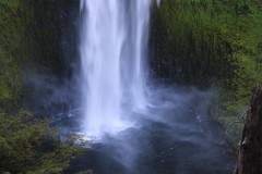
At the trailhead, we were welcomed with a heavy drizzle. We quickly added layers of raingear, trying to keep our base layers dry! After a group photo, off we went down the trail. This was not a gully washer, but an intermittent shower that came and went the entire day. Well…we were in a rain forest in April! Lots of trillium welcomed us along with bleeding hearts, solomon’s seal, ferns, and salmonberry to name a few. I did hear birds singing, but definitely not the same as a sunny day’s jaunt down this same avenue. This magnificent stand of timber within this coast range rainforest is a treat within itself; douglas fir, hemlock and red cedar, with ferns and wildflowers at their base. We often have glimpses of Kentucky Creek as we descend, and shortly into the hike we pass Upper Kentucky Falls. This fall is just as beautiful as the lower two, just different. Always fascinating to me to see how falls look different from one another, largely because of the rock formations beneath the flowing water.

Coming around that last corner before the double falls, brings a sense of awe. Two stunning waterfalls brim full of powerful rushes of water, Lower Kentucky Falls and North Fork Falls! At this point, a group of six wanted to continue downstream along the North Fork Smith River trail for a bit. This part of the trail encounters lots of small babbling streams trickling down to join Kentucky Creek. There were quite a few downed trees, and after the third set, four of us decided to find a lunch spot (two made it to the swimming hole…for lunch, not swimming). Edwin found the perfect restaurant with a view for the four of us; a large log with a picturesque view of Kentucky Creek, very enjoyable! We then headed back up.

My first trek along this path was March of last year, on a beautiful sunny day. The birds were singing so sweetly, wildflowers were at their peak, smiling in the sunshine. I have wanted to go back ever since and am so thankful I did!! It was not as stunning as in the sun, but definitely one of my favorites. I’d like to make this an annual event. But might be one to plan spur of the moment after checking out the weather – wink-wink!

Read more about this hike on Richard O’Neil’s blog, Richard Hikes

More pictures on Richard O’Neill’s Flickr page

Pictures below by Richard O’Neill

Elk Creek – April 16, 2022

Hike coordinator: Richard O’Neill

Narration by Richard O’Neill

Only 4 other hikers showed up for this hike. There was a reason for the low turnout, mainly the weather, so I didn’t feel like no one likes me, which may be true. We had sleet, snow, hail, rain, wind, cold and oddly enough, sun and warmth. If you don’t like the weather in Oregon, just wait a few minutes!

Read more about this hike on Richard O’Neill’s blog, Richard Hikes

More pictures on Richard O’Neill’s Flickr page

Pictures below by Richard O’Neill

Tahkenitch Dunes Loop – April 2, 2022

Hike coordinator: John Malone

A dozen or so hikers did some sand walking on this spring day on Tahkenitch Dunes. Some clouds, some sun, and a little sand in the boots made for an excellent combination of elements, which always reminds hikers they are on the Oregon coast!

Read more about this hike on Richard O’Neill’s blog, Richard Hikes

More pictures on Richard O’Neill’s Flickr page

Pictures below by Richard O’Neill

Rogue River Trail: Graves Creek to Whiskey Creek Cabin – March 19, 2022

Hike coordinator: Terry Andreucci

Narration by Terry Andreucci

March 19th turned out to be a typical spring day in southern Oregon… “If you don’t like the weather now, just wait, it will change”. Sure enough, that was the case!

After meeting up in Roseburg, we traveled south on I-5 to Wolf Creek and onto Graves Creek boat launch and the beginning of the Rouge River Wilderness Trail. The hike consisted of a 7 mile out and back from the landing to the historic Whiskey Creek Cabin along the Rouge River.

Jackets on, jackets off, rain gear on, rain gear off… that seemed to be the theme of the day, but it did not dampen the beauty of the scenery or the enthusiasm of the hikers! Early spring wildflowers covered the hillsides in some areas, while the river provided a wonderful array of views, rapids and sounds of rushing water.

During the hike we encountered a sighting of a bald eagle, a spectacular rainbow spanning the river and the interesting history of the Whiskey Creek cabin.

It was another awesome day, surrounded by the wonders of nature and the camaraderie of Friends of the Umpqua!

Pictures below by Rheo Wheeler
Scroll Up