Hike Coordinator: Coreena Gosselin
Pictures below by Coreena Gosselin
Hike Coordinator: Richard O’Neill
Narration by Richard O’Neill
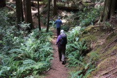
Well, we had a good turnout for this one, numbering about twenty or so hikers. It seemed like the fearless leader (me) was the only one familiar with the Cathedral Hills environs so this hike wound up being mostly a collective first time experience.
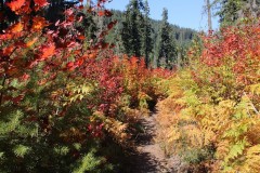
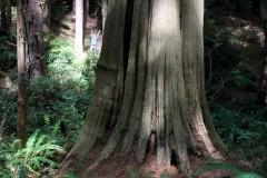
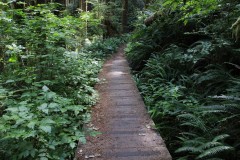
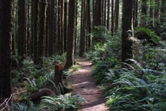
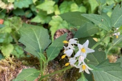
Cathedral Hills is a smallish park that is located just outside the city limits of Grants Pass. The park sports a woodland vibe with nice forests comprised of oak, madrone, manzanita, cypress, and other assorted conifers. But in spring, the wildflowers put on a show, especially a bright red one we don’t get to see in Roseburg, known as Indian Warrior.
Not only were these floral warriors brightly colored but they were plentiful, a virtual floral army waging a war against mere green forests. These plants are parasitic upon the root systems of madrone trees and there were plenty of those too. Also tapping into the madrone roots were patches of California ground cone, an odd little plant that looks just like a pine cone, as its name suggests. Poor madrone trees, they had to be wishing the kids would hurry up and just move out already!
There are many trails braiding in the park and it seemed like every five minutes we’d be at yet another intersection. That’s why a map is an essential on this hike and fortunately each hiker was supplied a map and cue sheet so we could finish the hike with the same number of hikers we started with. Basically, our route was following the outer contour of the park, starting from high at the Sky Crest Trailhead and dropping down to Espy Trailhead, and then closing the loop by hiking uphill back to Sky Crest.
Because of the park’s smallish size, it’s difficult to get in a hike over eight miles and our route was pretty close to six miles. It was a good day with bright blue sky, mild temperatures, copious amount of wildflowers, green woods, some views of nearby mountains, exercise, and just the overall joy of hiking. I think Cathedral Hills might find its way onto our list of “must do in spring” hikes.
Read about this hike hike on Richard O’Neill’s Blog
More pictures on Lane Harris’ Flickr page and Richard O’Neill’s Flickr page
Pictures below by Richard O’Neill and Lane Harris
Hike Coordinator: John Malone
Narration by Lane Harris
The club has been to Tahkenitch Dunes many times, but on this trip, John decided that we needed to hike it a bit differently than normal. The usual loop through the forest, out to the beach, and then some moderate sand-walking was apparently not satisfying enough. The solid path through the forest was not on today’s agenda, but in its place was, you guessed it, more sand!
The trek out to the beach was quite pleasant, and we all enjoyed the pleasant weather that was bestowed upon us. After collecting sand dollars and gazing over purple starfish in the sand, we headed inland towards Threemile Lake for lunch.
After gnawing on our sandwiches and meat sticks, the drudgery through the thick, soft sand leading back to the trailhead lay before us. Legs and calves burned as each hiker more or less hiked at his or her own pace. This created a good separation between those out front and the rest of us in the rear. This portion of the hike was an opportunity for each of us to be alone in our own Zenlike trance, questioning the great mysteries of life. Like: Why are we doing this??
As much as I don’t care for hiking in LOTS of sand, this is still a great trail that deserves repeat visits. However, I would suggest to forego the torturous sand route and take the forested loop route instead. There is still plenty of sand left on this hike to satisfy anyone with a voracious craving for the soft spongy stuff.
Read about this hike on Richard O’Neill’s Blog
More pictures on Richard O’Neill’s Flick page and Lane Harris’ Flickr page
Pictures below by Richard O’Neill and Lane Harris
Hike Coordinator: Lane Harris
Narration by Lane Harris
Lost Creek Lake sits smack dab between Medford and Crater Lake on Hwy 62. Amazingly though, when you mention Lost Creek Lake to most people, they have no idea where it is. At the size of 3,400 acres, this large body of water is popular for summertime watersports such as boating, skiing, wake boarding, tubing, and jet-skiing. And in the springtime, it’s a fine place to hike the surrounding trails.
On this day, the weather seemed to want to play with us, being a bit tempestuous at times on the drive south on I-5 from Roseburg. Was it going to rain? Was it going to be sunny? Or somewhere in between?…
When we arrived at the trailhead, we felt fairly confident the weather gods would be kind to us as we laced up our hiking boots. After I gave a quick brief, we walked across the road to the trail’s beginning and started the 1000 ft. climb.
This was my first hike with the club using my very first action camera, you know, like a GoPro. I told everyone not to worry about what they said as I filmed, as it would all be dubbed over with music. While that remark was received with some skepticism, no one seemed to mind the nerd with a small camera attached to the end of what appeared to be the world’s lamest trekking pole. I just held it high and proud, like a little kid who was nominated to be the flag-bearer in some sort of small-town parade, hoping that the big kids wouldn’t make fun of him later.
I knew that getting images of hikers in action would be the core of any hiking video I created. So how hard could it be? I mean, I hike with them, right? Well, as I was concentrating on getting some decent footage of our hike, I realized that every time I paused to film, the group would swiftly get further away from me. I would walk briskly to catch up, get some footage, and then rush to catch up again. Apparently, this would be my modus operandi for the rest of the hike. And quite possibly, for every hike from here on out if I was to capture the sleek, gazelle-like creatures, otherwise known as fast hikers!
While my legs ached and my shins screamed in pain, I contemplated the prudency of my decision in pursuing the fine art of producing amateur hiking documentaries. I think I can add “fast hikers” to what W. C. Fields famously said when he said “Never work with children or animals”. I mean, literally, what a pain!
I was fortunate enough to have some other not-too-fast hikers with me this day, so they were the lucky (?) stars that appear early on in my video production. Whether they were searching for the spotlight or just the mere reluctant recipients of being caught on video, I nonetheless appreciate their willing, or unwilling, participation.
Although the hike up to Viewpoint Mike gains 1000 ft from the trailhead, there are flat parts of the trail that one can just cruise and enjoy. Nestled between Hwy 62 and some private property, it at times feels like you haven’t gone very far off the beaten path. But when you turn a corner and disappear into thickets of pine and manzanita, you forget about how close to civilization you are. And speaking of manzanita, that was the crux of several puns we came up with on the trail. Example: What’s a manzanita on a hot, dusty trail? Water! (If you don’t get it, you’ve never hiked with me and Richard!)
At one point, a road walk is involved, but like my career in comedy, it’s very short-lived. The trail then begins the climb up, up, and up amongst a proper forest setting. This well-maintained trail is easy to walk on, and has one purpose: to get you to the top. The scenery on the way up may be unremarkable, but it’s certainly not disappointing either.
Within a quarter mile from the top, the trees give way to open, rocky terrain, giving hikers some hope that there must be something special up ahead. Upon reaching the top, we were rewarded with an amazing view of Lost Creek Lake to the north! And to the south? Just some stupid trees. But to the north, that’s where you look. And on this day, a rainbow had appeared as a bonus! We sat down and partook in the ritual which is lunch, and just generally had a swell time admiring the views. After our fill of sandwiches and rainbows, we promptly said goodbye to Mike and his viewpoint, and set off down the hill.
To the delight of my shins and legs, it was much easier keeping up with the gazelles heading downhill, as I filmed them prancing around in their natural habitat. Ok, so maybe the only prancing happening was me and my selfie-stick trying to get footage of our downhill escapades. (Is it just me, or does it sound wrong to use the word “selfie-stick” in ANY sentence?….)
As hikers spilled out onto the parking lot from the descent off of Mike’s quaint little viewpoint, we were thankful that the weather held and had provided us with another excellent day of hiking. And I, for one, am glad that no hikers were harmed during the filming of this hike.
Post-hike note: After the creation of my video, I must admit it came out pretty good! I won’t win any Oscars or Golden Globes, but at least I’ll always have my selfie-stick! (Again, that just sounds wrong…)
More pictures on Lane Harris’ Flickr page
Pictures below by Lane Harris
Hike Coordinator: Diane Rannow
Narration by Lane Harris
On a cool but pleasant day, Diane led a group of us from Floras Lake down the beach to a cliffside waterfall. Diane had already done the calculations to guarantee a low tide for this hike, thus ensuring that we had enough sand to walk on. The last thing you want is to have an encroaching ocean ruin your beach hiking plans! With Diane in the lead, the rest of us followed. Myself, Colby, Cleve, Robin and Keri were eager to get this hike started!
The southerly walk from Floras Lake is an interesting stretch of beach, as it passes by some very fascinating rock and cliff formations. Erosion has done an outstanding job of carving out mesmerizing walls, leaving large crevices, caves, and even archways for us hikers too ooh and ahh over. You really can’t help but to let your attention be taken away from the ocean to look at this marvelous rocky shoreline.
After reaching the terminus of the beach and taking some cool photos of the waterfall spilling over the side of the hill, we plopped down on the beach and had lunch. It was here where we contemplated our next move. Diane had already decided that a 5-mile round-trip hike for her was sufficient, and anyone who wanted to head back with her was free to do so. The other option was to be adventurous and continue on to Blacklock Point, with yours truly taking the lead. Apparently, everyone was feeling bold and exploratory and opted to continue on with our journey to Blacklock Point.
Since I was the only one who had been there before, and the only one with a GPS and a printed map, I assumed the role of hike leader for part II of this hike. I was up front with everyone by claiming yes, I had been to Blacklock Point before, but not from the direction from which we were approaching it from. But fear not, for there is trail nearby, according to my map!
We found the trail and headed south toward our destination. I do have to say that even with a map and GPS, trying to navigate amongst various side trails made for an interesting hike! My plan was just to stay as close as possible to the coastline until we got to familiar territory. With only one “where are we?” moment, we were mostly on course for the duration of the hike.
The plan of staying as close as possible to the coastline eventually paid off when the trail spit us out onto an incredible viewpoint just north of Blacklock Point proper. I was rather inspired about how close we were to our destination; it seemed as if you could almost throw a rock across the chasm and hit Blacklock Point (if you could a rock a half mile). At this point, I figured we would just cut back inland a bit, walk south and be there in no time flat!
It was when we headed back inland that we realized our simple plan was not going to happen, as there was a lack of trail in this thick coastal forest. We were forced to reconnect with the real trail that angles inland for about a mile before hitting the junction that would lead us back out to Blacklock Point, which was another mile. Sigh…
The trail that emerges from the forest and rounds around the south side of Blacklock Point produces a sense of anticipation to those who have never been here before. You just know that there must be something amazing right around the corner. And Blacklock Point does not disappoint with its amazing rocky cliffs and views. The beauty of this place is no secret, as we ran into quite a few other hikers who had trekked out several miles to enjoy this special piece of the Oregon coast.
One of the first things noticed are all the jagged rocks that are peppered out beyond the mainland. The larger ones appear to be lined up in a row, hinting to the fact that at some point eons ago the land had extended at least that far out. As erosion occurred, these stalwart volcanic rocks have refused to be washed away by the ocean, thus providing us humans with a satisfying visual feast.
In addition to the rugged coastline, newcomers are drawn to a thin route that heads out even further along the point, a somewhat precarious path for the daring. The first part of the trail is rather flat and easy, until hikers reach an area where the slim trail ekes its way along a nearly 45-degree slope. With the exception of myself and Colby, the rest of the group bravely ventured out to the tip of the point. I’m happy to report they all returned safely.
After a final glance at the ocean, we headed back from whence we came and headed back inland to get on the trail leading back to Floras Lake. As I am inclined to do, I took a slightly different route back, exiting the forest onto the beach just south of Floras Lake. It was here where the first rain drops of the day were felt. It appeared as if the sky might open up, so we all stopped to throw our rain jackets on. We had just strapped on our backpacks and started walking up the beach when the rain gods had apparently decided that their little rain prank was over. After only a few minutes of wetness, the rain was gone. Ok, so pack off, and rain jacket off. Stuff rain jacket back into pack. Put pack back on. Continue hiking. I’m sure the rain gods had a good laugh at our expense.
We arrived back at the trailhead after adding 10 miles to our hiking boots. This was a very worthy hike, and everyone agreed the highlight was Blacklock Point, but I have to give credit to Diane for organizing the hike. The walk down the beach is worth doing just by itself. Plus, if we had not hiked down the beach, we would not have had the adventure we had. I’m already thinking about how to do this hike again, minus the “where are we” moments…
More pictures on Lane Harris’ Flickr page
Pictures and video below by Lane Harris
Hike Coordinator: Brad Bishop
Narration by Brad Bishop (Some embellishment may have occurred during this tale)
Six Hikers decided to give the Bandon to Hells Kitchen trek a shot on a gloomy Feb 20th. The ride there was probably the worst part of the whole day as light rain and threatening skies tried to put a damper on our high spirts for a great beach day.
When we arrived we were rewarded with sunny skies and a wispy northerly breeze. As we departed on our southernly jaunt the crew spread out searching for beach treasure in the warm sunshine, while still keeping an impressive pace down the playa.
Around noon we all dropped our packs for lunch and interesting discussions on nothing in particular. Heading back we had to re-cross the three creeks that we forded to our turn- around point, but the mood was jovial, the pace was quick and the slight breeze was just enough to keep us comfortable.
As we neared the end of our journey we took a last look at the bizarre alien rock forms and wished each other a safe voyage home. It was indeed a great day for a walk on the beach.
Pictures below by Rheo Wheeler
Hike Coordinator: Lane Harris
Narration by Lane Harris
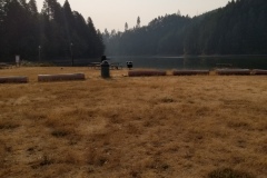
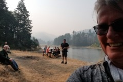
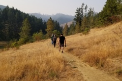
At our last hike planning meeting, I chose Cooper Creek for this date because I always think of February as the wild-card month when it comes to weather (Can you say Snowmageddon?) It’s best to choose those hikes that are at lower elevations, and if possible, close to home. Surprisingly, the weather was not all that bad on the day of the hike. A bit chilly in the morning, but dry for the hike. Perfect hiking weather, in my opinion.
As the vehicle count kept swelling at our regular meeting spot, I was thankful that the parking lot at Cooper Creek was as big as it was! We made the short drive to Cooper Creek and we were soon happily walking down the trail. It’s funny how a large group of people can suddenly appear small, or even disappear, within 3 minutes of a hike. Or maybe it’s just because everyone took off before I could finish filling out my $4 parking slip at the parking lot.
The Sutherlin Rotary Club, which built the trail, does a great job maintaining it. Us hikers are grateful to them for providing another trail for us to place our boots on. It will most likely become a favorite back-up place to hike if our club has to make last-minute changes in venues due to poor road conditions elsewhere, etc. But it does just fine as a planned destination, as was the case for today’s hike.
The plan for today was to hike counter-clockwise to the boat ramp on the Northeast end of the reservoir and then back, about an eight-mile hike. I offered two options to those who wanted a shorter hike, including continuing past the boat ramp for a two-mile road walk back to the parking lot, or if they wanted to, just wait at the boat ramp for a ride back to their vehicle. Little did I know that there would be an unknown third option waiting for us…
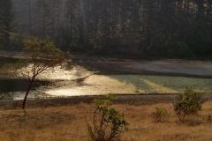
With approximately 15 hikers splintering off into smaller groups, it wasn’t long before the gang that I was in could see the group of speedsters already weaving their way to the boat ramp on the opposite shoreline. They appeared deceptively close, but I knew based on our location that we were a good 20 minutes or so behind them. We still had to wind our way around the eastern end of the reservoir before we were strolling along the same green path that they were currently on.
On the north shoreline there is picnic table sitting in an idyllic spot that makes for a great lunch spot. When we arrived there, I was a bit surprised that the group of quick hares hadn’t waited there for us slow tortoises. From this spot, you can also see the boat ramp, about a quarter mile or so up the trail. There are also bathrooms there. That must be where all the fast hikers went, I was thinking. A place which I must visit myself after a quick bite here at the picnic table. From this vantage point, I could also see what looked like a freshly cut path just on the other side of the boat ramp. Funny, I don’t remember that being there last year when we hiked here. It’s probably just a short path to the water’s edge for people to fish from, I thought, as I couldn’t see where it went.
The group of about eight of us sat and had a delightful visit eating our sandwiches and meat sticks. After that, some of us decided to make the short walk to the bathrooms. Upon arrival, I opted to ignore the call of nature, as I was immediately wondering where the group of sprinters ran off to, as they were nowhere in sight. They certainly did not turn around and go back the way they came, as we surely would’ve saw them. My mind instantly remembered that new path I saw on the other side of the boat ramp. I quickly darted across the road to check it out. Sure enough, a newly cut path continued westward towards parts unknown. Hikers are drawn to fresh, new dirt paths like flies are to honey. This MUST be where they headed off to: The unknown third option! After a quick confirmation with some boaters that the trail was put in just a month or so ago, I beelined it back to the picnic table to inform my group of slowpokes that the lightning crew had forayed down trails anew.
Again, I left the picnic table, this time making that long-delayed stop at the bathroom. Ok, I was good to go now. Our group was now ready to venture into the unknown! Pardon the excessive enthusiasm, but it’s not often that we hikers get to step foot on new trails, so it really is a treat when we get to.
Ahh, what a great day for a hike! The sun had come out, the birds were chirping, and we had not a care in the world. With an extra pep in our step, we joyfully strode upon this freshly blazed trail, while visions of a relaxing 2-mile stroll along the shoreline to the parking lot danced in our heads.
About a mile in, those visions abruptly ended. One of our members, who was ahead of us, was heading back towards us. Uh oh, this can’t be good. She said the trail kind of “peters out” up ahead. Decision time: Do we continue and see if we can pick up the trail, or head uphill and catch the road back? A few hikers had heavy packs on, they were training for the PTC, and they should probably go the safe route and hit the road. That was the decision made, and all those who were wise did the rational thing and headed uphill about 50 yards to the road and took the easy and safe way back. It was clear that continuing down the sketchy trail would be a task only fools would partake in.
As myself, Richard and Michael continued down the sketchy trail, we bid adieu to our coherent and rational fellow hikers. Nah, who needs them! They were just gonna get in the way of our untethered bushwhacking adventure anyway. Good riddance! Besides, we had Michael’s 2 dogs with us if things got desperate and we ended up in a survival situation… Ok, I’ll just let that one sit there for a bit…
We saw a few areas where the trail petered out (or peters out, I’m unsure now which one is correct). But we were able to follow ribbons which appeared to be where the trail was probably going to be properly constructed someday. In the meantime, we followed what seemed to be old game trails, and even human trails, likely created over the years as unofficial trails to access the shoreline. Overall, the last mile wasn’t all that bad, except for when it was. And no, we were never in any danger of getting lost, as we were wedged between the reservoir and the main road that parallels it the entire time. Admittedly, that did take the fun and excitement out of the whole thing.
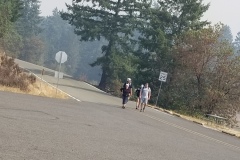
We eventually rounded the final point of land and lay eyes on the parking lot across the way. Just one final loop around some watery obstacles and we were soon on the road leading to the parking lot. In turned out that our fellow level-headed hikers who chose not to participate in our bushwhacking journey were only a few minutes ahead of us. Oh well, their loss.
In retrospect, Richard stated he probably wouldn’t hike that last part again until they have completed the actual proper trail. I guess I would agree, but I did, and always will, enjoy journeying into unknown areas that we haven’t been to yet. Oh, and also, I’m glad that we weren’t put into a survival situation with Michael’s dogs… Ok, I’ll just let that one sit there for a bit again…
Read more on Richard O’Neill’s Blog
More pictures on Lane Harris’ Flickr page and Richard O’Neill’s Flickr page
Pictures below by Lane Harris and Richard O’Neill
Hike Coordinator: Lane Harris
Narration by Lane Harris
The week leading up to this hike had been packed full of cold, rainy days, and the forecast had called for even worse weather on the other side of Saturday. As each day passed, I held my breath waiting to see if the very slim window of nice weather that was being reserved for Saturday’s hike by the weatherman was going to hold. By Friday night, I was pleased to see that the hike at Baker Beach was destined to be, at the very least, dry, and quite possibly, very sunny. Thank you, weatherman!
Ten of us hikers arrived at the trailhead at Dune Lake, which is near Alder Lake, both of which are near Alder Dune Campground… ok, is anyone else confused?… Anyway, before we set out, Bob noticed that Michael had a semi-flat tire on his vehicle. At which point, Michael asked, “What would Bob do?” After a few amusing remarks from the crowd, Michael decided that he would chance it and deal with the tire issue upon his return. (I really don’t remember what Bob’s advice was, as I was sidetracked by the whole WWBD: What Would Bob Do thing…)
We then hit the trail, everyone staying together in a group, as the trail has quite a few places where one could meander off onto false ghost-trails. We had barely gone half a mile when I was told that Michael had decided to turn around and go back. This is the part where he would prematurely “deal with the tire issue upon his return”. Apparently, he was calculating that his tire wouldn’t hold enough air for the duration of the hike.
As we trudged through more sand, I received a text message from Diana. She said she had camped at Alder Dune Campground, and was waiting to start the hike… at Baker Beach. I just shook my head and replied back that we had actually started where she camped at Alder Dune, and that we were heading her way to Baker Beach, just as it was listed on the hike description. After a few more texts back and forth, I ended up just calling her to say that yes, she started in the wrong place, and that no, do not go back to the beginning where we had started, as she would never catch up. After she spouted a few choice blasphemous words indicating her apparent self-disgust in herself for not paying full attention to the fine details of the hike itinerary, I told her that we were just a mile out and we would meet her at the Baker Beach Campground, to just wait there. Funny thing, we never heard from her again…
Just kidding. About a half mile later, Diane was spotted sulking down the trail towards us. She had decided to not wait for us, but rather opted to get some steps in. Her mood immediately improved though as we greeted her and she joined our merry little congo line heading back in the direction from which she had come from. Read the fine details, kids, it may save you some awkwardness later on.
We soon reached Baker Beach Campground and continued across the road on the trail known as the Lily Lake Loop, which loops down and around to Lily Lake at the most northern part of our hike. At Berry Creek, the trail basically does an about-face and heads south again across a high grass-covered dune, offering a nice photo-op of the land between us and the ocean.
As the trail continued back toward Baker Beach Campground, we had to skirt around several areas of the trail which were flooded with recent rain water. There’s wasn’t much to see along this part of the trail, but that’s sometimes typical during hikes. We soon arrived back to the campground and hooked a hard right toward the ocean.
The path that leads from the campground to the beach can be busy at times, both with humans and their equine companions. We would encounter both today, but it seemed much busier the day that I had pre-hiked this hike back on a blue-sky December day. The trail leads up and over a large dune, which wins the award for the greatest leg-burning hill of the day! Once at the top, we were rewarded with a fantastic view of our lunch destination, the beach! That glee soon dissipates heading down the other side, as you realize you will have to climb back up this side on the return leg! Ouch, don’t say leg!
Everyone pulled up a log and proceeded to chow down on a well-deserved lunch, as we watched distant ships float against a dark gray sky far to the west. This was the weather system that would move in later, long after we were done with our hike. But for now, we enjoyed the waves crashing against the sandy shores, along with horseback riders trotting up the beach. We watched with envy as the horses easily sauntered up the soft, sandy hillside that we had just come down. Unfortunately, us humans would have to traverse that quad-killing hill sometime after we finished our meat sticks and sandwiches.
While the rest of the group decided to beeline it back to the campground and chill, myself, Richard, John, Penny and Patty elected to be a bit adventurous and search for an impromptu alternative route to avoid the leg-busting sandy hill. Ok, so it was my idea, as I always have the best ones, and they always go as planned.
After hitting a dead-end near Berry Creek, I had a change of plans. We turned around and found a somewhat obtainable route to a dune that lay above us. I went first, having to crawl a bit on my hands and knees, tentatively negotiating the unstable sand-filled hillside, but was successful at the attempt. Looking back down on the doubtful-looking group, I could sense their excitement of the challenge the lay ahead of them. Richard grudgingly made his way up, then Penny, and then Patti. John hesitantly brought up the rear, and we were on our way. I then unashamedly announced to my exploratory hiking pals that they could now thank me for bringing back their own childhood memories of cheerfully playing in a sandbox. I valued what I assumed was their silent approval, as they solemnly brushed off sand from every part of their clothing, quietly mumbling to themselves. In this moment, I realized how much I was truly adored and appreciated whenever I lead hikes.
The five of us made it back to the campground and joined up with the others to make the 2-mile trek back to Alder Dune. By this time, the warmest part of the day, we were grateful for the pleasant weather and the warm sun on our faces. The air was cool, but not cold. The sand was… well, the sand was still sand, and it felt even harder to walk in on the return trip. What ended up being over 6 miles felt like at least 10 miles.
Oh, and in case you were wondering, Michael did make it to Florence and was able to get his tire fixed. He even stated he went to go check out Sweet Creek Falls near Mapleton while we were still hiking. That’s fine and all, but I feel it was a missed opportunity on my part to bring back precious sandbox memories to another appreciative hiker. Maybe next time.
Read about this hike on Richard O’Neill’s Blog
More pictures on Lane Harris’ Flickr page and Richard O’Neill’s Flickr page
Pictures below by Lane Harris and Richard O’Neill
Hike Coordinator: Richard O’Neill
Narration by Richard O’Neill
John and I were the only ones in our hiking circles that had ever done the cross-country trek across the dunes to Hall Lake…until now.
We were fortunate to be blessed with awesome weather the day of our hike. A dozen people showed up to marvel the wind-swept sand sculptures and sand art that had been created. Lunch was had at Hall Lake. And sand was poured out of boots at the end of the hike. A fantastic day in the great sandbox known as Dellenback Dunes!
Read more on Richard O’Neill’s Blog
More pictures on Richard O’Neill’s Flickr page
Photos below by Richard O’Neill