Umpqua Dunes – November 16, 2019

Hike Coordinator: Lane Harris

Narration by Lane Harris

Hikes that are scheduled weeks, or sometimes months in advance are never planned around the weather. No one can predict the weather that far in advance. So, we just schedule the hikes and hope for the best. And when those hikes are scheduled on the Oregon coast, well, that makes it even more unpredictable. And a hike scheduled in November? Odds are really good that you’re in for some cold, miserable weather…

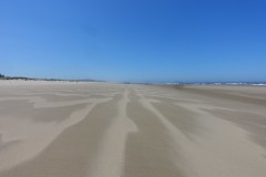
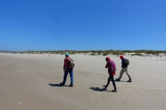
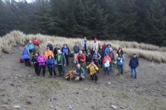
But, as it turned out on this particular day in the middle of November, it appeared we had beat those odds! A large group of us arrived at the Oregon Dunes day use area north of Reedsport, greeted by some very friendly weather and some very friendly fellow hikers from the South Coast Striders hiking group. The conditions were so good, that many of us hiked the entire hike with just short sleeved shirts. Exceptionally calm winds with mild temps made for great hiking!

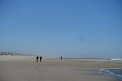
The caravan of hikers departed the parking lot and headed down the hill and towards the foredunes. The mile-long walk to the beach offers up a mix of part sandy desert, part forest, and part dune before promptly spitting hikers onto the beach. We took an immediate turn south, as the plan was to walk the beach all the way to Tahkenitch Creek. Several hikers opted for the shorter, 4-mile loop back up, which was achieved by only walking a mile and a half down the beach and then turning back inland toward the day use area. The rest of us made the long journey to where Tahkenitch Creek empties into the ocean.

The beach offered several distractions on the long trudge, including huge logs that had washed ashore, seagulls frolicking in the water, and jellyfish the size of frisbees, and larger!

After the long beach walk, hikers sat atop logs and such near Tahkenitch Creek and dined on whatever hikers bring for lunch. After a long respite here, we donned our backpacks once again and headed back north up the beach.

By this time, all hikers had been spread out as thin as that last bit of butter on a piece of toast, and we were in groups of only 2 or 3. At what is apparently milepost 114 on the Oregon coast, everyone turned inland for what would eventually be the strenuous part of the hike.

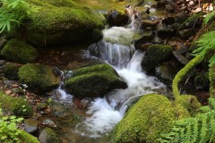
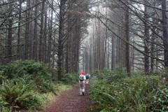
The trail was kind enough, as it meandered through the foredunes and a lush, forested knoll. Hikers caught a few glimpses of Tahkenitch Creek before the trail turned north towards the trailhead.

It was the last 1.5 miles that made us wonder why we decided to do a marathon hike to Tahkentch Creek before we turned around. The sand was deep and not the easiest to navigate. Anyone who has walked through deep, thick sand knows it takes twice as much energy to walk through it than walking on a solid surface. According to that math, then that last part, according to our legs, was really 3 miles, not 1.5!

All hikers made it back, thankful for the kind weather that mother nature had delivered. For those of us who did the whole enchilada, this was a rewarding 8.5-mile hike. Umm, better make that 10!

Read about this hike on Richard O’Neill’s Blog

More pictures on Richard O’Neill’s Flickr page and Lane Harris’ Flickr page

Pictures below by Richard O’Neill

North Umpqua Trail: Jessie Wright Segment – November 2, 2019

Hike Coordinator: Lane Harris

Narration by lane Harris

The Jessie Wright section is named after Jessie Wright, who with her husband Perry, built a homestead on nearby Illahee Flats in 1915. They must’ve been hardy people, to reside in a place that dictated that you live a life of day-to-day survival. And to think that we now traipse around this area for mere recreation. And it’s a given that Jessie and Perry Wright would’ve killed to own a pair of Gore-Tex boots!

It was 36 degrees at the trailhead when 13 of us hikers headed out on this portion of the NUT (North Umpqua Trail). Ahh, but the sky was blue and the sun was actually shining. Ok, so it wouldn’t keep us warm the whole day, but the thought of knowing that it was there somehow warmed the soul.

This section of the NUT is where the trail crosses the river and stays on the north side of the highway and river. Theoretically, this means we would be on south-facing slopes, meaning we should see more sun as opposed to being on north-facing slopes. In theory. In reality, we probably caught the sun’s direct rays about 10% of the hike. Oh well, we’ll take it!

The trail started out fairly level, but soon offered up a few gentle climbs and one steep switchback going downhill. This was gonna be fun to come back up! Eventually, the trail made its way back towards the river, and was absolutely level in some places as we paralleled the North Umpqua River. We walked through the burn zone that occurred several years back, noticing that the forest was recovering quite nicely. However, that same fire totally destroyed a bridge that this hiking club had actually paid for as a way to cross Eagle Creek. Hikers must once again hope the creek isn’t flowing too high as they encounter this part of the trail. Today, all it took was a long step across.

Upon reaching Boulder Creek, we took a long lunch break on a sandy area near the creek. As we jockeyed for positions in the few sunny spots, we discussed about turning around here or going forward. All agreed that this would be a good turn around spot. This section of the trail continues on for about another mile and a half to Soda Springs Dam, but that part of the trail is basically along an old road and is nothing to write home about.

On the return leg, the air was actually heating up, by autumn standards. Most everyone shed one layer and enjoyed the leisurely hike back. Well, except for that steep switchback, this time going uphill! But overall, it was a very satisfying hike on a fantastic fall day.

Read about this hike on Richard O’Neill’s Blog

More picture on Lane Harris’ Flickr page and Richard O’Neill’s Flickr page

Pictures below by Lane Harris

North Umpqua Trail: Hot Springs Segment – October 19, 2019

Hike Coordinator: Richard O’Neill

Narrative by Richard O’Neill

Yup, it was raining, yesirree. That might explain why only 4 hikers set out on the North Umpqua Trail beginning at Toketee Lake.

But really, it wasn’t raining that hard and besides which, that’s what rain gear is for. So, accompanied by the steady patter of rain drops striking hat brims we set off on the trail and were immediately greeted with a colorful palette of autumn hues and colors. The forest along the river was really putting on a show with pink dogwoods, yellow bigleaf maples, and multi-hued vine maples making things festive despite the inclement weather.

By the time we were nearing the Deer Creek bridge, our intended turnaround point, the rain abated and a good hike was taken to the next level. On the way back, our two photographers Tim and Richard lagged behind speedwalkers Lindsay and Patti,  as the camera-toting duo felt compelled to take photos of everything, be it colorful leaves, emerging mushrooms, crusty lichen, coursing river, or anything else that struck their photographic fancy. 

Because of the rain, we did not stop for lunch so we availed ourselves of that opportunity at the covered pavilion at the trailhead. And right on cue, the heavens opened up. Lunch just tasted better when accompanied by the sound of rain on the roof and we all agreed we had partaken of a grand hike and actually felt sorry for everybody that stayed at home because of the weather.

Read about this hike on Richard O’Neill’s Blog

More pictures on Richard O’Neill’s Flickr page

Pictures below by by Richard O’Neill

Muir Creek – October 5, 2019

Hike Coordinator: Lane Harris

Narration by Lane Harris

It was a clear, chilly day when the envoy of nine hikers arrived at the trailhead. We had two new hikers join us this day, Rita and Ruth. Liz also joined us, her second time with the club. Regulars John, Edwin, Diane, and Coreena rounded out the group with Lane and his son Colby.

Prior to setting out, 4 walkie-talkies were handed out to various people so we could keep in touch as we would inevitably be spread out along the trail. Several of us had hiked this trail before, but it had been many years ago. We thought it would be a good idea to bring the radios, just in case information needed to be relayed to others about trail conditions or if the trail is difficult to follow or find. That decision turned out to be a very wise one for the reasons just stated.

Our single group of nine quickly split into 4 distinct groups, each one with a radio. John, Edwin, Coreena and Ruth sprinted out front, followed by Lane and Colby. Diane was her own group of one, while Liz and Rita brought up the rear.

It wasn’t long before John reported trees across the trail. Then a required log crossing to get across a creek. Then a spot where the trail was hard to follow. Then more trees. Then another creek crossing. Needless to say, this information passed via radio was valuable to everyone, as we all helped talk the next group through this obstacle course they call the Muir Creek Trail. Lane even left orange trail flagging at key parts of the trail to help other hikers navigate through portions of the trail where it got a bit sketchy.

All but 2 hikers made it to the designated lunch spot. Liz and Rita turned around early, apparently discouraged by nature’s cruel trick of putting trees across the trail. Perhaps they were onto something with that decision…

After a quick lunch, the faster group did what they did on the way up, which was to hike fast, this time back towards the vehicles. Diane, Lane and Colby decided to make a detour to see the actual falls prior to heading back.

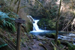
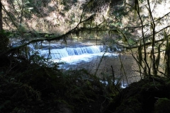
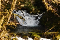
This little excursion to the falls made all the log and creek crossings worth it! A small but tedious rock-hop across the creek was the cost of admission to see the falls up close. After grabbing some cool photos, the trio jumped back across the creek and headed back down the trail.

With all heads accounted for back at the parking area, we all agreed that having the radios with us made this hike possible. We were able to pass along vital information about trail conditions, knew where everyone was, and also when hikers were turning around. It certainly made things easier and allowed us to have a very enjoyable day on the trail.

More pictures on Lane Harris’ Flickr page

Pictures below by Lane Harris

Cowhorn Mountain – September 21, 2019

Hike Coordinator: John Malone

Narration by Lane Harris

Cowhorn Mountain used to have a tall spire pointing straight up toward the thunder Gods, acquiring its name from its pointy peak. But that tall spire was struck down by the thunder Gods when lightning struck it in 1911. This resulted in a flattish surface where those who venture to the top can take a well-deserved respite upon. But the privilege of resting your buns atop the ‘horn is not easily obtained.

Eight of us gathered on this summer-like day in mid-September. Not one cloud was visible in the blue sky above and the air was cool. A perfect day for hiking! Our hike began at Windigo Pass to the south of Cowhorn Mountain where Windigo Pass road intersects the Pacific Crest Trail, otherwise known as the PCT. Since the majority of this hike is on the PCT, we enjoyed a gentle grade as we made our way up.

The trail loosely follows a ridgeline through the forest, offering occasional views of Mount Thielsen, Mount Bailey, and Windigo Lakes. As we rounded some corners, we would see Cowhorn Mountain looming tall above us, it’s craggy and jagged edges making it appear impossible to even think about climbing it. And every step closer made it look increasingly larger and even more intimidating.

We eventually arrived at a rock cairn at the base of the mountain, which indicated the detour from the main trail to the path leading up to Cowhorn Mountain. With its close proximity to the PCT, Cowhorn offers a nice distraction for thru-hikers who are willing to drop their packs and make the climb.

The kind, gentle slope of the PCT was now behind us, replaced by a much steeper grade as we made our way up the western ridge of Cowhorn Mountain. The distance to the top is probably a mere quarter mile, but its surely one of the toughest quarter miles around! We slowly made our way up the steep, pumice-laced trail, encountering multiple switchbacks along the way.

After reaching a false summit, we crossed a barren crest of red lava before starting the zig-zag path once again up the final approach to the mountain. It is here where the trail basically ends and hikers are left to climb, hand over hand over rocky ledges and outcroppings, choosing their own pathway to the top. Although not a death-defying feat, only those who are comfortable with their own abilities should attempt this final scramble to the top.

Alas, we were not alone way up here! A mountain bike club from Eugene had made this their destination as well, minus the bikes of course. They had left those down near the PCT prior to climbing up. They had ridden up from Timpanogas lake earlier in the day and were already at the top of Cowhorn when we arrived. Soon, we were joined by even more adventurous souls, as miscellaneous hikers trickled their way up the mountainside. It was as if a call went out announcing that this may be the last sunny Saturday of the season to enjoy fantastic views of the Cascades!

And from the top of Cowhorn Mountain, the views were indeed fantastic! The large prominent lake to the north was Crescent Lake, with Summit Lake showing itself off in the northwest near Diamond Peak. To the far north were the Three Sisters and the top of Mount Jefferson. Off to the east lies Cowhorn’s nearest neighbor, Sawtooth Mountain.

After eating lunch and soaking in views from what felt like the top of the world, and figuring it was getting a bit crowded up here anyway, we left the ‘horn and began the precarious reverse scramble back down. Legs were in constant brake mode and trekking poles were a hot commodity as hikers attempted to slow their descent down the short but steep mountainside.

Upon reaching the PCT again, it was an easy walk down the PCT, this time without all the huffing and puffing. We made good time going back down, encountering several backpackers who were heading northbound. It was a busy day in this neck of the woods! We were soon back at our vehicles, thankful for a great hike on perhaps one of the last sunny summer-like days in September.

More pictures on Lane Harris’ Flickr page

Pictures below by Lane Harris

Thielsen Creek – September 7, 2019

Hike Coordinator: Richard O’Neill.

Richard led a small party up the Thielsen Creek Trail on a day that felt like it was going to rain. The day before, a lightning storm had breezed through the area and already, smoke from numerous fires had hazed up the air. However, the incoming storm system tamped down the smoke and the hike was thankfully fire free.

Read about this hike on Richard O’Neill’s Blog

More pictures on Richard O’Neill’s Flickr page

Photos below by Richard O’Neill

Buck Canyon – August 24, 2019

Hike Coordinator: Edwin Case

Narration by Lane Harris

When arriving at a designated wilderness area to hike, the last thing you expect to find, besides a nice sandwich shop that serves ice-cream.. mmm, wouldn’t that be nice… are a large herd of cattle. Yet, that’s what was there to greet seven hikers as we approached the Buck Canyon trailhead to hike into the Rogue-Umpqua Divide Wilderness. The slow-moving livestock blocked the road as we were just yards from the parking area. We’d see more of them on the hike, but only at the lower elevations. Thankfully, no cows were harmed on the way to the trailhead.

The trail leading up into Buck Canyon, which is actually the headwaters for West Muir Creek, a tributary to the upper Rogue River, is a beautiful stroll through meadows and forests. It starts near a small meadow, requires a short hop across Muir Creek, then makes a gentle climb on the north facing slope of the canyon. Heading west, we were immediately in Hummingbird Meadows, which gave us northerly views of the far side of the canyon. For a late summer hike, the meadows were still green, but they couldn’t totally hide the early autumn tone that was starting to set in.

The trail maintained it’s gradual climb, and we began encountering more and more trees that had fallen earlier in the year, no doubt due to the heavy snowfall the area had in February. None were impassable, just slight nuisances. Hopefully, trail crews will clear these out in the near future, as this hike is truly one of the best in the area that showcases beautiful meadows.

This section of the trail had been trodden upon quite heavily by all the free-ranging cattle. This was a blessing and a curse at the same time, as we were grateful for a clear path, but our eyes were constantly aimed downward as we dodged all the cow pies along the path. Thankfully, no hiking boots got cow crap covered.

Just over the 2 mile mark, the highlight of this hike is revealed when you step out of the forest and into a spectacular open field! At first glance, Devils Slide on the opposite side of the meadow appears to be just a hillside with a rocky composition. But when you consider it was the result of a massive slide that occurred many eons ago, only then can you imagine the devastation it caused as it slid down from the mountain above 1000 feet to the creek below. The huge boulders blocked the creek and instantly created a small lake. This lake eventually filled up with silt, becoming the magnificent meadow you see today.

This picturesque meadow is an excellent spot to hang out in and explore, and then turn around and go back to the vehicles. But on this day, we were feeling exceptionally ‘hikey’ and none of us had ever explored much further beyond this point, so we just kept walking…

Immediately past the meadow, the trail slipped back into the timber and started uphill again. It was here that downed trees were even more prevalent than they had been before. These were all ‘step-overs’ and required no limbo maneuvers. At one point, the trail took a merciless steep climb directly skyward, and muscles strained as each foot of altitude was gained. This climb was short-lived, but most of us would’ve preferred trees to climb over! Thankfully, no muscles were hindered by cramps.

Our well-earned reward was yep, you guessed it, another meadow! We decided that this would make a fine place to dine on sandwiches and enjoy refreshments. Once completed, we just couldn’t help ourselves and decided to go just a bit further. The map showed that there could be a viewpoint of sorts just about a mile up the trail, so off we went, recharged by our nice long break.

We reached a rocky plateau, and based on our coordinates, determined this was the viewpoint. The view was limited to the north, but a view nonetheless. After a quick group photo, we turned around and headed back down the trail.

We made good time heading downhill, and when we got to the first meadow where Devils Slide is, it was suggested that we do a little exploring of the meadow. So we began our childlike romp through fields of green. The meadow consisted mostly of tall, wavy grass, which did a fine job of concealing narrow, foot-deep channels from which water flowed through during the rainy parts of the year. Some hiking boots managed to discover these channels quite by accident. Thankfully, no ankles were injured during the channel discovery process.

As we neared the trailhead, we could hear our bovine friends calling us in, the same ones that greeted us near the trailhead. As we approached our vehicles, they scattered like teenage boys who had just been spotted doing things they shouldn’t have been doing. Upon closer observation, it was evident that they had taken a liking to our large metal modes of transportation, as there were snot smears aplenty all over the windshields, windows and doors. Thankfully, no vehicles were permanently harmed by the pranking of the cows.

More pictures on Lane Harris’ Flickr page

Pictures below by Lane Harris

Twin Lakes – August 10, 2019

Hike coordinator: Penny Groth

Narration by Lane Harris

Imagine planning a party where you send out invitations and generate an extreme amount of interest in your party. Then, when the big day arrives, only your immediate family shows up. That pretty much sums up this club hike up to Twin Lakes.

Despite 100’s of likes, multiple “going” and “interested” clicks on Facebook, only six of us regulars showed up to what turned out to be one of the best spring-like hikes one could have in the middle of summer. The small turnout was probably due to an event that rarely occurs during the month of August – rain! Truth be told, all those excited no-shows really missed out!

An overcast, yet non-threatening sky followed us all the way to the trailhead at Twin Lakes. It was apparent that other would-be hikers had stayed home this day, as there was but one lone vehicle sitting there. After only a half-mile into the hike, we encountered two wet backpackers heading back to their lone vehicle. After sharing their exploits, we carried on, knowing that we would have the lakes to ourselves. For those that are familiar with Twin Lakes, you know that summer months usually brings droves of hikers and campers to this corner of the world. Today was a rare exception.

A few spatters of light rain kept the air cool, making it feel as if we had jumped back in time, way back into April! After passing through several meadows still in summertime bloom, we arrived at the shelter, which is usually occupied with nature-loving people. We walked past the shelter and down to the first lake, which was covered in a low, light fog. Continuing around to the second lake, and then back to the first, the group reconvened at the shelter and took a quick break, soaking in the abnormal coolness which had befallen us this day.

The second part of this hike would take us up to the overlook and back, so we began the gradual climb uphill. We passed through more meadows where flowers and plants showed off their colors. Many of them flourished in areas of burned out timber where a fire had raced through years before. We were not counting on any kind of view of the lakes, due to the fog we had seen at the lakes. But upon reaching the overlook, we were rewarded, to a certain degree, of the lakes below. This was a good thing, as it was impossible to see anything else. No mountains, no sunshine, nothing. But at least it was dry while we sat and had lunch.

While Penny and Patty decided to walk the final mile to the upper trailhead before returning to the vehicles, Rheo, John, Lane and Colby decided to call it good and hike back down. Prior to reaching the parking area, we encountered two separate groups of people hiking up to the lakes, with no less than a dozen in each. Apparently, there were other parties scheduled here as well. At least at this party venue, there was plenty of room for everyone.

More pictures on Lane Harris’ Flickr page

Pictures below by Lane Harris

Mount Scott – July 27, 2019

Hike coordinator: Lane Harris

Narration by Lane Harris

One thing is certain when you visit Crater Lake, you are NOT alone! This also applies to the hiking trail which leads to the highest peak in the national park, Mount Scott. By the time our party of nine had reached the trailhead, there were already droves of hikers on the trail, both coming and going.

This late July hike began with a gradual climb among firs and pines, which kept us shaded for a good part of the hike. However, as we climbed higher, the trees got sparser and the trail got a bit steeper. Heavy-breathing hikers reached for their water bottles and dabbed sweat off their brows in the midday heat. As we gained altitude, the teasing, eye-pleasing views looking back towards Crater Lake gave us inspiration to keep going. We knew there had to be a spectacular view awaiting us at the top!

Many hikers were already heading back down. Others were quickly on their way up. In fact, some of us slower hikers were easily passed by some of these more enthusiastic hikers who were obviously eager to get to the top. Most appeared to be young, college-aged, and athletic that looked primed for a triathlon. Passing by us like we were standing still and reminding us of when WE were young. Sigh!

Anyway… The trail threw no less than five switchbacks at us as we drew near the top. Each one gave us a better view of the lake below. Eventually, we rounded a corner and the lookout which sits atop Mount Scott finally came into view. We were nearly level with it! An easy jaunt across a treeless ridgeline, which provided tremendous views to the north and south, led all those who made the trudge up this mountain to the base of the lookout.

As we dined on our early afternoon lunches, next to the multitude of other hikers, everyone soaked up the beauty of that which is Crater Lake. The quintessential pictures of Crater lake, typically taken from close to the rim, cannot compare to the panoramic landscape view that is attained from two miles away at 8,934 feet!

From Mount Scott, you get a more expansive overall picture than you see from the crater’s rim. Viewing the lake from this distance puts everything in this area into perspective. From this vantage point, you get the true sense of the massive explosion that took place over 7,700 years ago. All that remains now of Mount Mazama is a crater nearly 6 miles wide! You can only imagine the devastation that took place here.

Mount Scott, which lies to the east of Crater Lake and within the park’s boundaries, not only provided true birds eye views of Crater Lake itself, but many mountain peaks. Unfortunately, there was no long-range views to the west due to the Milepost 97 fire which had just started 3 days earlier. A stream of smoke could be seen, hovering the earth as it flowed southward. A sad reminder of the perils that we deal with during the summer months here in the great northwest.

After a group photo on the ridgeline, we pointed our hiking boots downhill to begin the easy stroll back down, this time without all the heavy breathing and sweat! By the way: No young people passed us on the way down. It’s hard to walk faster than the more “mature” people who need to use the bathroom, get home to take their meds, and get in bed before 9:00.

More pictures on Lane Harris’ Flickr page

Pictures below by Lane Harris

Mule Creek – July 13, 2019

Hike Coordinator: Edwin Case

Mule Creek is a small tributary creek to the Rogue River, and has carved a deep canyon that is truly amazing. The cliffside trail crosses the creek multiple times before charging uphill to Panther Ridge.

When things got a bit warm, overheated hikers frolicked in Mule Creek to cool off. Deep gorges carved by the creek were quite amazing to view. When not gazing across large canyons, hikers focused on some of the flowers and plants that were in bloom.

This was a worthy hike that everyone enjoyed!

More about this hike Richard O’Neill’s Blog

More pictures on Richard O’Neill’s Flickr page

Pictures below by Richard O’Neill

Scroll Up