Yellow Jacket Loop – June 29, 2019

Hike Coordinator: John Malone

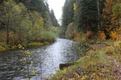
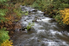
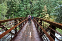
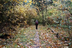
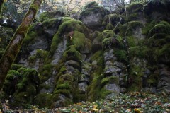
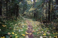
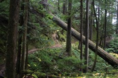
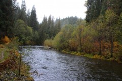
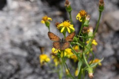
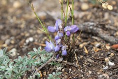
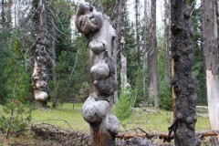
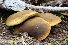
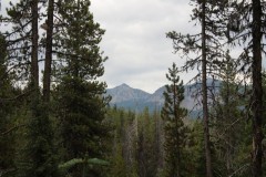
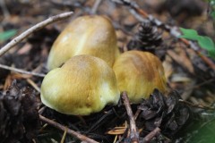
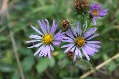
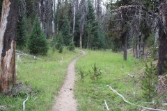
You just can’t beat Yellowjacket Loop in the spring! Although the unappealing name conjures up images of pesky stinging insects, this was not the actual case during this hike. A good sized group showed up to hike this trail which begins near Hemlock Lake. The trail ambled through expansive and lush meadows while wildflower blooms burst with color! Views of nearby Cascades peaks awarded the hikers once they reached the top of Flat Rock. This is a worthy 5.5 mile trek that, being so close to us locals, just can’t be beat.

Photos by Brad Bishop

Boccard Point – June 15, 2019

Hike Coordinator: Brad Bishop.

On June 15th we decided to stretch our legs a little and head on down to Boccard Pt. above Ashland. The crew for this adventure included David, Terry, Coreena, Missy, Kylie, Mike, Arleigh and myself. The weather report called for temps up to 90, but with the forest cover and a gentle breeze that was a non-factor.

The springtime bloom was in full abundance for most of the first two or three miles (and last two or three). Lots of Orange, Red, Yellow, Blue and Purple mixed with the dominate Green.  As we got near our departure from the PCT to Boccard we were rewarded with sneak-peaks of a snowy Shasta and Mt. Eddy.  The fairly rocky, but well worn trail to the point ended up giving us the payoff of great views of Shasta, Mt. Eddy, Trinity Forest and the Marble Mountains as well as the Klamath River Valley and Pilot Knob Rock.

After a quick lunch at the point we headed back the 5 miles from whence we came including the sneaky two mile uphill climb once we joined up with the PCT again.  Overall we hiked the 10 miles in about five hours and even though we worked hard on some spots I think everyone had a great time.

Pictures by Brad Bishop

Samuel H. Boardman Campout – June 6 – 9, 2019

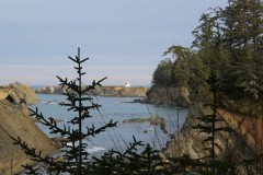
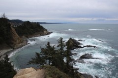
The Friends of the Umpqua Hiking Club’s annual campout typically takes place in August, but due to all the wildfires that have occurred in recent years, which we’ve had to work around, the club played it safe this year and opted to have it in June. Not only that, but we decided to camp on the coast where wildfires are extremely rare. Perhaps this was a knee-jerk reaction, but for the few that actually attended, that reaction was rewarded with excellent weather and beautiful coastal scenic views!

A total of four brave campers showed up to camp and hike on the most southern portion of the Oregon coast. Harris Beach State Park was home base, while Samuel H. Boardman State Scenic Corridor was the main venue for hiking activities. Richard, John, Edwin and Katchan enjoyed great vistas here and appeared to be having a great time, as evidenced in the photos.

More about this hike on Richard O’Neill’s Blog

More pictures on Richard O’Neill’s Flickr page

Pictures below by Richard O’Neill

Dellenback Dunes – June 1, 2019

Hike Coordinator – John Malone

Narration by Richard O’Neill

While Roseburg was baking under an unseasonably early heat wave, nine Friends of the Umpqua enjoyed a respite from the heat by hiking at the coast. While sunny, a brisk breeze kept things cool to the point we were were wearing light jackets and windbreakers pretty much all day.

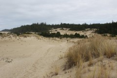
Dellenback Dunes is such an alien landscape, it wouldn’t have surprised us to see giant sandworms emerge from the dunes to eat us. But looks can be deceiving, as the sands were quite benign, the only threat being sand in our boots. Several hikers were first-timers to the dunes and they were suitably impressed with the both the beauty of the dunes and the burning of leg muscles from hiking in soft sand.

Once we crossed the dunes on the large whaleback dune, we hiked through the marshy forest partly on trail and partly on boardwalk. Fortunately, the marshy bits were fairly dry and we arrived dry-footed, at the beach in short order. 

From there it was two mile’ish walk to Tenmile Creek, which really looks more like a river where it reaches the ocean, and we ate lunch behind a sand berm that provided some shelter from the constant breeze. Plus, the berm also prevented airborne sand particles from spicing up our sandwiches as we ate. 

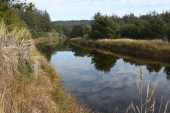
There is no trail from Tenmile Creek so we simply went cross-country through the marshes, scrub forest, and dunes. Fortunately, again the marshes were fairly dry. The route spit us out onto the dunes proper and we were rewarded with the vista of Tenmile Creek snaking through the sandy landscape. 

A cross-dune walk of several miles closed this 8 mile hike out and regretfully, we returned to Roseburg to rejoin all our sweltering friends and family members.

More on this hike on Richard O’Neill’s Blog

More pictures on Richard O’Neill’s Flickr page

Pictures below by Richard O’Neill

Haceta Head – May 18, 2019

Hike Coordinators: Penny Groth and Diane Rannow

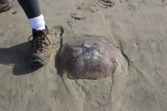
Eight hikers began this wonderful hike along the beach.  It was a picturesque Oregon morning with that blend of clouds, patches of blue, and mist that us ocean people love!  We encountered rocks, shells, jelly fish, goose neck barnacles, seaweed, and more.  You know, the stuff we come across quite often at the ocean.  And always, it reminds us why we love it, as we explore and take in the view with awe.

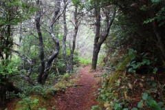
Then hippity hop up the hobbit trail; oh what a treat with its tunnels and wonderfully unique tree formations!  And to boot, those huge, absolutely gorgeous, rhodies in bloom.  It’s quite a climb but one does not notice while entranced with the distinctive surrounding scenery.

Emerging from the hobbit trail, we headed toward the lighthouse.  This portion of the trail was covered in a forest of spruce trees with their smooth bark, and at times, twisted trunks.  Lush foliage in this coastal climate are a beautiful feast for eyes: False Lily of the Valley, ferns gently unfolding to face spring, salal with its graceful blossoms, young nettles, and salmonberry .  Diane was able to identify some for us; whatever their names, we soaked in their beauty!  Views of the ocean below from on top were amazing!!  And then the lighthouse slowly came into view from the trail.  What a beaut!!  One of the prettiest and most photographed within Oregon.  And we added to those numbers…click, click, click!

After lunch, the drizzle began to increase.  We were thankful it had held off this long, but decided to pick it up a little.  We did skip the Valley Trail portion of our original planned route and re-hiked the hobbit trail and along the beach.  But who can complain, it’s the Oregon coast, and even in its somewhat typical drizzle was, as Diane would say, “lovely, lovely lovely”.  For sure! I believe we all were glad we’d come.  There was some discussion before we left Roseburg that morning as to possible change of hiking location due to the dim forecast and possible traffic in Florence of the Rhododendron Festival.  But we decided to stick with the plan, and so thankful we did.  It was a good one!!

Pictures by Penny Groth

North Umpqua Trail: Mott segment – May 4, 2019

Hike Coordinator: Lane Harris

Narration by Lane Harris

On this grand spring day, no fewer than 10 happy hikers hit one of the few open sections of the North Umpqua Trail. But even the Mott segment, from Mott bridge near Steamboat down to Wright Creek bridge, didn’t go unscathed from Snowmageddon back in late February. Recently downed trees were evident on the trail from the unusual heavy snowfall, but the trail crews did a great job at clearing this part of the trail.

This one-way 6 mile stroll was ripe with floral flaunter, with the dogwood trees all abloom, stealing the show with their pure white petals gleaming in the sunlight.

Other highlights on the Mott section included charming babbling creeks, scenic river access points, and the site of Zane Grey’s fishing camp. Us more “mature” hikers like to ask younger hikers who Zane Grey was, with the question usually conjuring up blank stares. (If you are a younger person, and you DO know who Zane Grey is, give yourself a pat on the back!)

As far as hikes go on the N.U.T., this is the most level section of the entire trail. Without much elevation gain, this makes it a popular segment for joggers, which our group saw several of. While we were heading down river, other hikers were encountered heading up river in the opposite direction. Although “up” is just a relative term in this case, as the trail is basically level here, as stated earlier. But knowing we were heading “down” just made us feel better, a psychological maneuver that usually works on us hiker types.

The entire group made it to Wright Creek, vehicles were retrieved back at Mott bridge, and we all wore smiles on the way home.

More on this hike on Richard O’Neill’s Blog

More pictures on Lane Harris’ Flickr page and Richard O’Neill’s Flickr page

Pictures below by Lane Harris

North Bank Deer Habitat – April 20, 2019

Hike Coordinator – Richard O’Neill

Narration by Richard O’Neill

This was an adlib hike the entire way. The original destination was Yellowjacket Loop but the road was blocked by winter debris and inaccessible. To further complicate matters, the erstwhile hike leader injured a knee so a new hike leader (Richard) and destination (North Bank Habitat) were recruited. Seems like every time Richard leads a hike, it rains and today was no exception.
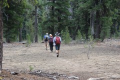
Well, maybe rain is the wrong word. We weren’t pelted with fat raindrops gravity bound, but the air was decidedly liquid and artificial gills were required. With all the water swirling round, it stood to figure that Soggy Bottom would be just that, and it was. Boots were wet before long and then they were muddy as the soggy road sucked at our boots. We had two hiking veterans and two newbies and all of us were California ex-pats. Missy didn’t know what poison oak looked like and with all the ample red-leafed growth flanking the trail, she quickly learned to spot the accursed shrub. “Gosh, it’s everywhere!” she was heard to utter.
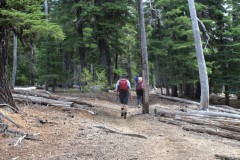
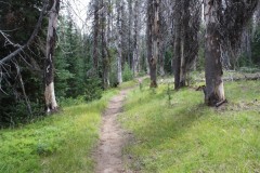
That’s why we stay on the trail, folks, and I don’t think any of us were unduly exposed to future itchiness from brushing up against the Devil’s favorite shrub. The trail climbed steadily uphill, soon leaving the forest behind for open windswept grassy slopes. Now we were unduly exposed to the elements and if we weren’t wet then, we were now. Despite the low cloud cover, the views of the creek valleys heading into the North Umpqua impressed.

Because of the weather, we “shorted” this hike too, dropping off the North Boundary Ridge into more sheltered Blacktail Basin. A good-sized landslide had taken out the trail but we safely scrambled over. 7 miles on a rainy day wasn’t bad and we all had a good time in spite of or because of the weather. 

More about this hike on Richard O’Neill’s Blog

More picture on Richard O’Neill’s Flickr page

Pictures below by Richard O’Neill

Sterling Mine Ditch Trail – April 6, 2019

Hike Coordinator Richard O’Neill

Narration by Richard O’Neill

Another hike, another rainy day forecast. However, we really skated weatherwise because the only rain on the day was on the drive to and from the hike. The day was overcast and the temps cool and just perfect for hiking.

Sterling Mine Ditch is the remnants of a flume ditch hewn into grassy slopes, the purpose to siphon water into the hydraulic and placer mining activities in the late 1800’s. Today, the ditch is still eminently visible and its banks make for a nice trail for the hiking and mountain biking crowd. The steady grade means the trail is mostly level, although there was a pretty good uphill pull when the route left the ditch and contoured around some private property.

The windblown slopes were sparsely vegetated, consisting mostly of yet leafless oaks, madrone, and manzanita, but mostly it was grass. The lack of vegetation allowed for what normally would be expansive views of the Siskiyou Mountains. We could see down the deep Little Applegate valley all the way where it joined up with the much larger Applegate Valley. Wildflowers were beginning to bloom and we all enjoyed our first look at the elegant grass widows and Henderson’s fawn lily.

At about the 5 mile mark, we stopped to visit the Sterling Mine Ditch tunnel. Because Tunnel Ridge was too formidable an obstacle to dig a ditch around, a tunnel was cut into the intervening ridge. We all felt sorry for the workers (mostly Chinese laborers) who did the actual work of boring through the ridge.

A short walk down the exceedingly beautiful Tunnel Ridge Trail delivered us to the end of this hike.

More about this hike on Richard O’Neill’s Blog

More pictures on Richard O’Neill’s Flickr page

Pictures below by Richard O’Neill

Applegate Lake Payette Trail – March 23, 2019

Hike Coordinator: Richard O’Neill

Narration by Richard O’Neill

It’d been a long time since the club had hiked on the east side of Applegate Lake so it was about time. It was a sparsely attended hike, bad weather was in the forecast, but the 4 of us were pleasantly surprised with balmy temps and no rain. The Payette Trail follows the shore of the lake, ducking in and out with all the coves and bays the lake serves up on its erratic shoreline. Unlike the trails here in Douglas County, the Payette Trail was mostly fallen-tree free and clear. The trail alternated between madrone forest and brushy manzanita near the lake’s waters. Or what little water there was, the lake was still drawn down for the winter.

Amazingly, we were catching little patches of sunlight but all that came to an end when we plopped down for lunch at naturally, the farthest point away from our car. We could see the storm coming, a veritable black wall of angry cloud swooping down from the hidden Siskiyou Mountains. Sure enough, the storm announced its arrival with several minutes of strong gusty wind followed by a steady rain for the rest of the day.

To shorten our time in the rain, we took the Osprey Trail shortcut which went up and over a forested ridge and we did encounter one rather large tree laying on the trail and blocking the way. It was a pretty sodden bunch of hikers peeling off wet clothing and muddy boots but as usual, we enjoyed the hike and felt sorry for all those that stayed at home in a warm dry house.

More about this hike on Richard O’Neill’s Blog

More pictures on Richard O’Neill’s Flickr page

Pictures below by Richard O’Neill

Scroll Up