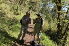
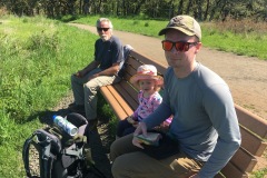
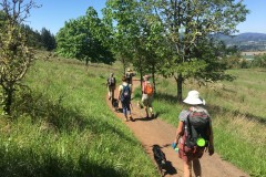
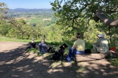
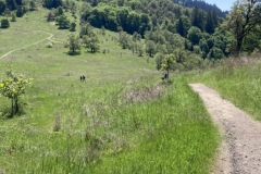
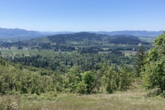
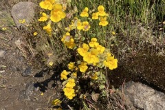
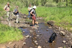
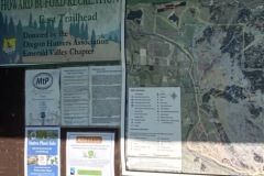
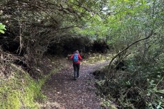
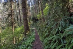
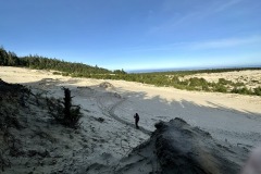
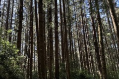
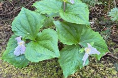
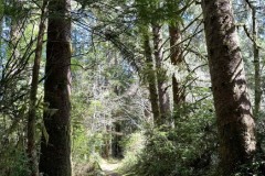
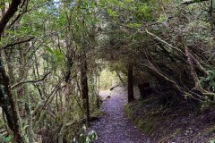
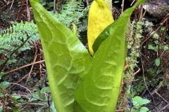
Some foolish hikers decided to trek through the sands of Tahkenitch Dunes this April Fool’s Day. Ok, so maybe it wasn’t so foolish, as it was a gorgeous day for a hike on the coast! This club favorite has a little bit of everything, from lush forests to sandy dunes and of course, the beach. Always a crowd pleaser, the variety of terrain keeps hikers coming back for more.


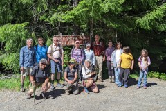
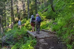
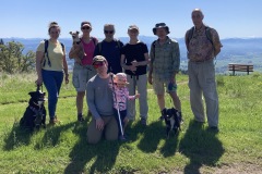
On this marvelous March day, Terry had at least a dozen hikers make their way to the trailhead near Graves Creek to hike the always-lovely Rogue River Trail from the boat ramp to Whiskey Creek and back. With a handful of man’s best friend tagging along, not a dull moment was had this day.
There was a chill in the air when the large group started, and right away we were traversing the small swollen creek that runs near the parking lot. Unbeknownst to us, this would be a small practice run for what lay further ahead on the trail…
This was one of those days where everyone had their rain jackets on, as there was that feeling in the air as if it may rain at any moment. But just like when someone puts a near-empty milk carton back in the fridge, barely a drop was to be had. We experienced some grey skies and some sun. Kinda perfect weather, really. Cool, but a little sun to keep you warm when not hiking.
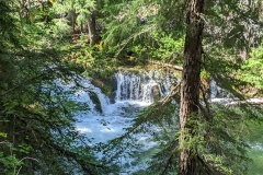
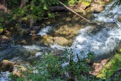
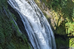
As we made our way down the trail, there were several creeks which required some clever negotiating. The recent rains and snow had made all the local creeks absolutely engorged with water! Looking across the river, one could make out many waterfalls cascading off the hillsides, with snow still present on the highest part of the hills.
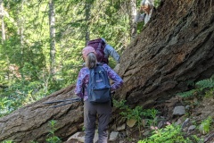
At one point, we all had to make a short scramble off below the trail to avoid the rushing water that had pretty much inundated our path. To attempt walking down that watery way would have been quite risky, with the slippery footing underneath surely having the last laugh. Thankfully, no hikers were smitten by the water gods this day.
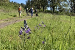
Normally, all the wildflowers are just bursting with color this time of year. But due to the long, late winter we’ve had, the flowers were just starting to do their thang. Give this place another a few weeks or so and the real show should be in full swing!
After successfully crossing multiple creeks running across the trail, we eventually reached Whiskey Creek cabin. As the group did a self-guided tour of this historical site, I was doing a little looking around too, and found a geocache, totally unintentionally! It was an ammo box locked to an old cable just uphill from the cabin. With curiosity, I took a quick look inside, then placed it back where I found it. (TIP: If you ever stumble upon a geocache and are not actually participating in the sport, please be courteous and leave it where you found it so others who are looking for it can find it) I always thought geocaching would be a neat thing to do, but just haven’t made the effort. You need a GPS to participate, but I typically use mine to prevent from getting misplaced in the woods!
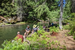
After having a late lunch along the edge of Whiskey Creek, the group made its way back upriver. We were all spread out along the trail, just enjoying the magnificence solitude and the grandeur that is the wild Rogue River. Although we ran into quite a few other hikers this day, it just reaffirms that this place is worthy of visiting, and visiting often, as evidenced by the amount of people who walk these banks of the Rogue River Trail.
“If the plan doesn’t work, change the plan but not the goal.”
~ Anonymous
I imagine this anonymous guy or girl must’ve had a big hike planned and had to change it at the last moment. Ok, so I guess that quote could fit almost any given situation when a plan goes awry. Regardless, it certainly applied to today’s planned hike to Cape Mountain near the coastal town of Florence, although it more or less did not come as a big surprise.
I had been watching the weather forecast all week, keeping a keen eye on Saturday. Depending on which tv channel I watched, which app I looked at on my phone, or which website I saw, they all seemed to be anticipating less than desirable conditions for hike day. Well, ain’t that a kick in the ol’ hiking pants! As the day drew nearer it was appearing, at least to me, that the gloomy forecast had lightened up a bit, and maybe it wasn’t gonna be as bad as they said it was going to be. (BTW, who are “they” anyway?…)
I was somewhat optimistic as I pulled into the parking lot at 7:45am, imagining that I would have a good little group who were eager to be adventurous and brave a little rain, and poo-poo all those so-called weather forecasters. So far it was just John and Tracy who had arrived and were ready to go. No problem, we had 15 minutes for the other hikers to arrive. Ah, here comes one now. It was Edwin. Ok, so that makes four of us. Tracy then mentioned that she was not up to driving 5 hours (roundtrip) to hike in the cold. And so began our discussion about the weather, the cold, the possible snow, rain, etc. I said, “Perhaps we should wait to make any decisions until everyone else shows up.”
It was now 8:05 and everyone else did not show up. The four of us were the “everyone else.” Oh, wait here comes another…. oh, never mind, it’s just a random car passing through the parking lot. We discussed our local hiking options, and finally settled on Cooper Creek Reservoir just east of Sutherlin. Edwin, who had previously stated that if we changed the hike that he would probably just go home, did just that. I can’t say I blame him, as he’s been there done that when it comes to all the local hikes. I sent a text to Rebekah, an interested hiker on the coast, informing her that we were not hiking at Cape Mountain today. She was going to meet us at the trailhead, and I didn’t want her waiting for us unnecessarily. So, it was just the three of us now, and with that, we climbed into my truck and sped off. We had just changed the plan but not the goal… to go hiking!
Once we were at Cooper Creek, I decided I better call Tom with the South Coast Striders. His group was also planning on meeting us at the trailhead near Cape Mountain, and I was envisioning his gang of angry coastal hikers waiting around in the rain for us mild-mannered inlanders to show up. To my relief, however, he informed me that he had only one person that was interested, so they pretty much bowed out of the whole thing. I love it when a plan doesn’t come together!
John, Tracy and I started the 6.2-mile hike around the reservoir under nasty skies. The rain wasn’t heavy, but it was cold, and even turned to wet snow for a while. There was even a bitter wind, acting all windy and such. But once we got under the canopy of the trees, it wasn’t so bad. And after maybe 30 minutes of hiking, the weather actually got better! The wind and rain ceased, and it was quite pleasant. Yes, it was still 37 degrees, but compared to what the forecast was, we accepted this as a gift from the hiking gods.
Our hike was rather uneventful, which was fine with us. Lots of waterfowl were spotted, fish were jumping, and I even saw a rabbit! Parts of the trail were a bit muddy, but that didn’t bother us at all. We were just happy to be hiking and not being drenched in cold H2O. That’s never really all that much fun, trust me, even on a Richard hike. Unsurprisingly, we did not see any other hikers this day.
Upon returning to Roseburg, I checked my phone. I had received a text back from Rebekah on the coast. Her response to my cancellation was “That’s ok, this was a mile out from the trailhead anyway.” Attached was a picture (the last one in the slideshow below) of a snow-covered road with several trees across it, blocking any would-be hikers from reaching the trailhead near Cape Mountain. 😲
Thus, our smart decision to change plans but not the goal was validated with that photo. I’ll say it again, I love it when a plan doesn’t come together!
Fifteen eager hikers gathered on a cold (but dry!) morning at the courthouse. Destination: Heceta Head lighthouse and trail! Upon our arrival at the lighthouse, we were joined by 10 – 15 Striders (Coos Bay hiking club). So, well, there was a mob of us (a friendly one)!!
Leaving the parking lot, we journeyed up the half mile wooded path, passing the picturesque caretakers house, then on to the lighthouse. Then up, up along the trail, including a lot of fairly steep stairs (bun-burners for sure – ha)! Alas … the reward at the top – an awesome view of the ocean.
Continuing through a beautiful stand of Hemlock, we crossed Hwy 101 and hopped onto the Valley Trail: peaceful, lush green forest, wetlands, ponds and creek runoff. At Washburn State Park, we crossed back over Hwy 101. Just in time for lunch on the beach. Oh my, what a pretty February day! Sun AND no wind. We found the perfect log to perch … we resembled a lineup of turtles on a log in a pond. But nope, it was us basking in the sunshine!
We toodled along the beach, then up the Hobbit Trail (no hobbits sighted) where we intersected with our beginning trail. It was a little sunnier on our return trek, so that awesome view of the ocean on our way up – well might have been a bit more awesome!!
We did a tad more than 7 miles, 7.2 to be exact. With lots of up and down, this trail offers a variety of scenery for the eyes and soul. Rest assured, it’s a good one!
With a nicer weather forecast for our hike day, we had a good turnout for our trek through the South Slough Estuary. Eleven F.O.U. members plus 3 from the South Coast Striders out of Coos Bay joined up at the information center.
With no information on the Slough’s website, we were surprised to see the parking lot nearly full, and the bathrooms were under construction. They had a class in chainsaw handling, which drew in a few people. Most important though, they had brought in port-a-potties, since the bathrooms were out of commission.
We headed downhill through the forest to the water area where there was an 8+ foot tide covering all the mudflats. This is a very easy 3+ mile hike over boardwalks and forest trail, with the hardest part at the end where it’s uphill back to the start.
After our leisurely stroll at the slough, the group split up, with some opting for clam chowder in Charleston, others heading to the beach at Seven Devil’s, and others just wanting to head home. It was a very pleasant day in a beautiful area.
Dellenback Dunes was a 6+ mile hike in the wind and rain. Not ideal conditions when you have a spectacular destination, worse when it’s a slog out and back with no beach time. King tides of 8+ feet kept us in the dunes for this test of our raingear.
We had a great turnout of 18 hikers and 4 dogs for this adventure and hopefully they won’t hold this against us and come back when conditions are better. Yardangs (wind sculpted sands) were not as prevalent as earlier in the week with rain obstructing long range views as we headed north along the deflation plane.
Everyone had a good attitude, despite our inclement weather: Welcome to Oregon in winter.
Blacklock Point is one of the most beautiful spots on the Oregon coast, and hardly anyone knows about it. This rugged headland, just north of Cape Blanco, is one of the wildest spots on the coast. Although traffic on Hwy 101 whizzes by just a few miles away, few travelers make the effort to find this lesser-known gem on Oregon’s south coast.
As the 14 of us gathered near the boat ramp at Boice-Cope Park near Floras Lake, the weather looked much better than anticipated, and thankfully it was dry for most of the hike, with only a few small sprinkles coming down a handful of times. Starting from the shores of Floras Lake, we headed south along the Oregon Coast Trail, winding our way through thick forests until reaching the main trail.
My intent was to make a few off-trail excursions prior to reaching the Point. The first creek we had to first cross would provide us our first off-trail excursion, albeit unplanned and unwelcomed (Odd thing, all this water wasn’t here 3 weeks ago when I had pre-hiked it). As several members scouted out different routes around the boggy mess, I took the lead, as that is what one does when leading, and I forged ahead. After Kevin’s trusty companion Minion tried in vain to cross, Kevin decided to call it and headed back to his vehicle. One hiker down. The rest of us did our best to keep boots dry, as we attempted to stay on the high parts of this marshy environment, eventually reaching the small foot bridge. Well, foot bridge is a misnomer in this case, as most foot bridges have places to put your foot. This one consisted of no more than a few slippery boards which must be carefully navigated. One end was submerged as we leapt across the creek, most of us making a dry landing. (Emphasis on “most of us”) Needless to say, we were not looking forward to doing this all over again in reverse…
After making our way up the other side, I led the group to our first planned excursion, which was a point from which you can see arch rock (not sure if that’s the real name…) and the beach from above. I noticed that a few hikers were not with us. After making our way back to the trail, we determined that Richard, John, Scott, and Shannon had disappeared. Literally. I knew for a fact that I was in front prior to exiting the trail, so we determined that they must have been lollygagging behind us, missed the exit, and kept on going. We later learned that the lollygagger was John, who decided to do a little trail maintenance by cutting a small tree off of the trail. The other three waited for him, and thus they began their own adventure. Four more hikers down.
The remaining hikers traipsed up the trail, eager to get to the next excursion. Soon, we departed the trail again, popping out the other side to more cliffy views. This particular one is on the north side of a waterfall that can just be seen tumbling below the cliffs. It was above this waterfall that the plan was to hop across the small creek that feeds the waterfall and scramble up the other side to another viewpoint. But once again, we had more water than we knew what to do with (Funny, all this water wasn’t here 3 weeks ago). With determination, most of us (Emphasis on “most of us”) leaped across at several different areas. I gave verbal directions to those now on the other side of the creek, telling them that myself, Rheo and Kathy would go back up the main trail and meet up with them at the next viewpoint near the other side of the waterfall.
After going back up the main trail and failing to meet up with them, I questioned my so-called hike leading abilities. I’m fairly certain that misplacing hikers is something that was to be avoided. Yet, here I was, killing it. By my count, I had managed to lose another half dozen hikers. I was fairly certain that this would be the last hike I would ever lead, thinking that I would be voted off the island by the end of the day. Or maybe just thrown off the top of Blacklock Point, assuming I had any hikers left with me to carry out said feat.
Thankfully, the whole gang was waiting for us just up the trail, admiring another fantastic ocean view atop sandstone cliffs. So far, these views hadn’t come easy, as swollen creeks had to be leapt over and thick brush had to be scrambled through. But that’s the price to pay in order to reach lofty precipices that few people ever venture to.
The trails in this area pass through thick coastal forest, affording occasional glimpses of the mighty Pacific Ocean. There are many intersections and a myriad of ways to navigate these trails, so it’s highly recommended to hike with someone who is familiar with this area. We did manage however, to run into Richard, John, Scott, and Shannon again prior to reaching Blacklock Point. They had already been to the Point and were on their way back. After sharing our misadventures, my group continued up the trail while Richard’s headed back toward Floras Lake. I was a little disappointed when Lance announced that he was choosing to go back with Richard. He had apparently had enough fun with my group. On a brighter note, this would be the last hiker that I would lose this day.
Rounding the corner to Blacklock Point, the scenery opens up, grabs you, and doesn’t let go: Before you lies Blacklock Point’s dark crumbling promontory, which juts out to a series of rocks and stacks, the most impressive being Tower Rock. Views extend to the large sea stacks of Castle Rock and Gull Rock, as well as the Sixes River Mouth and Cape Blanco, Oregon’s westernmost point. Brave hikers teetered along a sketchy trail that leads along the spine of Blacklock Point to obtain incredible views in all directions.
After a well-deserved lunch, we returned the way we came. This time, no off-trail excursions were planned. Also, we knew we had to cross that marshy bog and the so-called bridge, so that in itself was gonna be an adventure…. again. We arrived at the swollen creek, and much to our surprise and relief, the water had receded, and by a lot! We merrily strolled across, knowing that the worst was behind us now. I was relieved, as I was certain if I were to lose another hiker, it would’ve been in this watery mess somewhere, as the marsh could’ve swallowed up any unwary hikers.
Arriving at a junction, Rheo, Kathy, Michael and Missy decided to go back via the main trail. I guess this wouldn’t count as losing hikers, as this was their choice. Meanwhile, myself, Colby, Cleve and Moriah diverted off the main trail toward the beach so we could get some sand beneath our boots. The beach just south of Floras Lake offers views of more golden sandstone cliffs, only this time we were below them, peering up in awe. After a mile or so of beach-walking, we headed inland and back to the parking lot at Floras Lake. We started out with 14 hikers, I came back with 3, plus myself. In my estimation, I think that’s a win.
We were all feeling somewhat fortunate, as we had just journeyed through nearly 10 miles of coastal beauty that very few experience. Even better, I was not voted off the island or thrown over a cliff this day. I imagine I’ll live to lead another hike on another day, and have additional opportunities to lose more unsuspecting hikers. I can’t wait.
Well, this one was more unusual than most of my unusual outings.
What was going to be ‘The Powder to Chowder’ hike in celebration of the start of the beginning of this year’s ‘Worst Hike Ever’ took a turn in a direction that I never would have dreamed of. It was a weird coincidence that in 2022 we began on the 1st day of the year and ended on the 365th at North Bank. There was no snow, but it had rained pretty steadily the couple of days before, so I was figuring wet and sloppy. Maybe change the hike to Slop and Soup.
So, there were nine of us ready to send 2022 into the junk heap of time and start celebrating the anticipated 2023 Nirvana that was on the horizon.
We gathered in the Comstock Lot and headed out to the Bucktail Basin. Everyone seemed in good spirits and the trail wasn’t too wet and the temp. was inviting for a brisk walkabout. After about ¾ of a mile I came over a ridge and much to my surprise a small shepherd type dog appeared out of nowhere and started cantering towards me. The first thing I noticed was that it had a weird gait. I thought, poor guy, must have gotten one of his back legs injured. After he (actually she) got closer I realized I was mistaken there was no leg there. As I bent down to pet her, she was kind of whining but didn’t seem distressed. As the rest of the crew came up, they greeted the doggie with Love and Warmth. I peered down the trail expecting to see her owner, but no one was in sight. She seemed to bond with our group and hobbled along up the trail keeping Missy’s dog company. I thought we’d see her owner down the trail.
Well, it was a pretty easy trek until we came upon the steam crossings which were flowing pretty good. So little tripod was still with us but there was no way she would have gotten across without being swept downstream. Remember in Lord of the Rings when they did the dwarf toss? Well, this was dog tossing at its best. After surveying the situation, and the majority of the hike still ahead, Super Ginger Coreena, Missy and Mike decided to take our little stowaway back to civilization.
I was somewhat relieved as I knew some of our top animal lovers had decided to take action and I felt much better about the outcome of the situation.
The rest of our group continued on the journey. It seemed like the part I was most concerned about, Soggy Bottom, was pretty nice actually, not too sloppy AND the sun showed signs of breaking through. As we navigated the last water hazard and hung a right past the barn, we saw a trio coming towards us in the distance. It was the Three Musketeers. First thing I noticed was that little tripod was absent. My mind went through all the worst-case scenarios, but I noticed they had small smiles on their faces. They proceeded to fill me in about how they got back to the parking lot and wondered what was their next step. Coreena was already planning on her game plan about adopting her, but all the while they knew they had to first see if they could reunite the little one back to her family.
After canvassing anyone they could find and turning up no leads, an Oregon Police Officer happened by. He hadn’t heard about any lost dogs, but would check with the caretakers. BINGO! It wasn’t the care taker’s dog, but they knew the owners.
“PIPER”, as it turns out, was with her family and got separated. She had been out there two nights. Her family had gone out looking for her for a couple of days with no luck.
Anyway, it’s always good to have a happy ending. We had some chowder, quiche, cookies, and sparkling cider. We talked about the joys of getting older, and had that warm and fuzzy feeling for maybe saving a little life.
So let us take this attitude into the new year to give a little more love and taking action on our compassion. See you when I see you. Have a great 2023.
We had an even dozen show up for the Cooper Creek hike. This is somewhat surprising due to the nasty rainy windy forecast, but the clouds parted, and we had a sunny start, rainy middle, with a somewhat clearing ending. New people and new dogs all seemed to have an enjoyable 6+ mile hike around Cooper Creek Reservoir. Had a lolly-gag at the 2/3 mark at the east boat ramp with all under a somewhat protective tree.
This hike was meant to be a lovely jaunt along the Oregon Coast at the funky little seaside town of Bandon. Much to my dismay a couple of weeks before the hike date I was informed that not only was there going to be a high tied that day, but it would be a King Tied. Due to the shortage of rescue swimmers in our club I decided the new title for the hike would then be ‘Swept By The Tidal Wave To the North Bank Habitat”.
Only Four of us this time out; The Prez, The Legend, The Tree Spirit and yours truly. This did not surprise me as this was the weekend of giving thanks and a lot of members were probably recovering from Tryptophanosis. (As a public health suggestion, Friends of The Umpqua Hiking Club would like to say try not to overindulge, but if you do hiking is a good way to counteract the negative effects) It was good hiking weather, Mid to upper 50s and though it had rained the night before the trails were firm and there was no threat of a shower.
As we arrived at the West Entrance, two K9’s playfully attacked my truck, probably recognized me from a previous life, no doubt I probably owed them money. Once the maps were passed out, I explained the route. We would start from the parking lot and proceed to the Oregon North Bank Habitat Chasm Creek Trail, which I prefer to call the OR. Chasm Trail. From there we would hook up with Middle Ridge Trail and continue onto Bucktail Ridge making a nice little six-mile loop. The Legend stated that the last part of the OR. Chasm Trail was an ass-kicker. Now, I respect the opinion of The Legend as he has hiked hundreds if not thousands of Umpqua Miles, but I figured maybe he was just suffering lingering effects from Tryptophanosis. Besides, it was only a couple of inches on the map.
Off we took on our adventure at a refreshing lively pace past shedding fall leaves and non-diversity practicing cattle. Taking a right turn on to the OR. Chasm Trail things were going extremely well. The trail was firm, our pace upbeat we were frolicking along. May I even say we were having a gay old time.
Then things got serious. The OR. Chasm Trail had started its upward climb. Time to start taking off clothes. Heart beating faster. Breathing deeper. Getting lost in the aura of what nature had to offer on our quest to the climax of this unexpected physical climb. Small breaks along the way to catch our breath then continuing on. We were almost to the top. Holding on just a little longer. And then… We made it!
We all had a cigarette and a snack at the picnic table. Just kidding about the cigarette. (As a public health suggestion, Friends of The Umpqua Hiking Club does not condone inhaling smoldering vegetation. Unless of course it is fire season) But I digress, and we did digress down The Middle Ridge into the cool, light grey atomized mist. It was a fairly uneventful decent except for the UFO landing site. We did meet a few bipedal creatures, but no sign of aliens.
We arrived at the parking lot about 11:30. Guess you could say it was a quickie.